Area of Focus
The Area of Focus is the geographic region included in the NatureCheck analysis. It encompasses lands owned or managed by EBSN partner agencies. Note that not all lands owned and/or managed by partner agencies are included in the Area of Focus. The Area of Focus excludes shoreline habitats because these are assessed in other cross-jurisdictional collaborative projects.
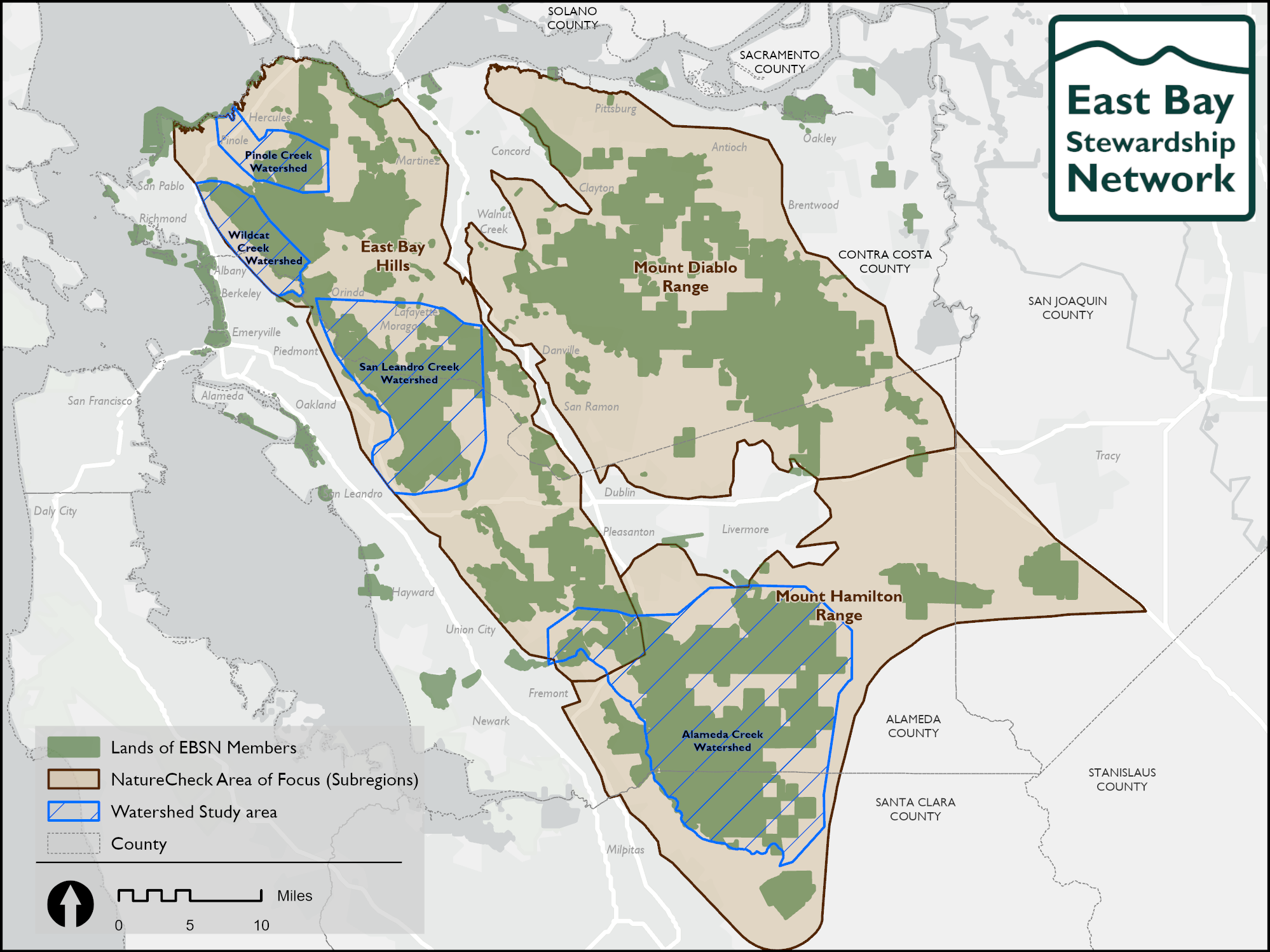
Explore the subregions, habitats, and watersheds below.
Subregions
The Area of Focus is split into three subregions, East Bay Hills, Mount Diablo Range, and Mount Hamilton. Where it makes sense ecologically, analyses of indicators were done at the subregion level in an attempt to capture some of the variation across this large geographic area. Subregions are based on the Conservation Lands Network landscape units.
Habitats
Birds were analyzed in groupings called “guilds,” and we define them as those species that exploit the same resource—in this case, a vegetation or habitat type. The 28 bird species we analyzed were divided into four groups (with unequal numbers of species in each group) based on the type of vegetation the species are typically found in: riparian, grassland, oak woodland, or shrubland – the latter with an emphasis on birds in chaparral shrublands.
Watersheds
A watershed is a geographical area of land where all precipitation drains to a common outlet, such as a river, lake, or ocean. Surveyed streams are grouped by watershed (Pinole Creek, Wildcat Creek, San Leandro Creek, and Alameda Creek), and the condition and trend of associated native fish populations are evaluated at the watershed level.