Puma (Puma concolor)
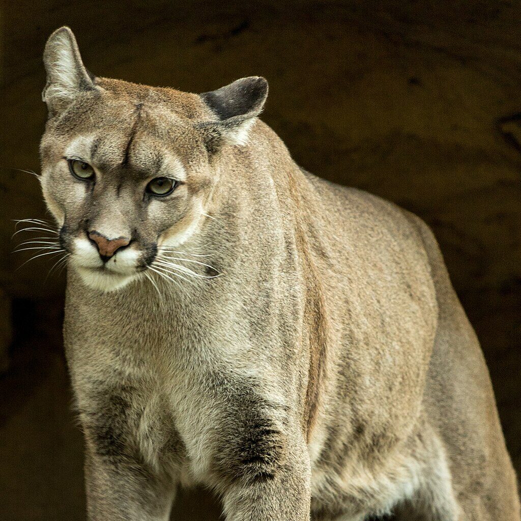


Puma can be found throughout the Americas and is also known in some areas as puma, mountain lion, cougar, panther, and catamount. Puma are shy and need large areas to roam.
What metrics determine the health of this indicator?
Metric 1
Puma documented annually in each subregion.
Caution
Unchanging  Moderate
 Metric 1
Puma documented annually in each subregion.
Geographic Area


Condition Thresholds
Good
Pumas are detected annually in each subregion.
Caution
Pumas are not detected in one or more of the subregions in any given year.
Significant Concern
Pumas are not detected in any of the subregions over a two-year period.
Metric Current Health Findings
Current Condition
Current condition is Caution based on the average of conditions below:
- East Bay Hills and Mt. Hamilton: Good. Pumas were documented in both the East Bay Hills and Mt. Hamilton subregions as recently as 2020.
- Mt. Diablo Range: Significant Concern. Pumas were not detected in the Mt. Diablo Range subregion in monitored Network partner lands.
Current Trend
Current trend is Unchanging:
- East Bay Hills and Mt. Hamilton: Unchanging. Pumas were detected in monitored parks in the East Bay Hills and Mt. Hamilton subregions from 2012 to 2020, with some detections each year.
- Mt. Diablo Range: Unknown. Without detections for the Mt. Diablo Range subregion in the monitored parks, it is not clear if the monitoring was insufficient to detect any pumas that may be there, or that pumas are not there; there were no time series to support a trend.
Current Confidence
Current confidence is Moderate. Monitoring data (camera trap studies) and records from EBMUD lands were recent and reliable for a subset of Network partner agencies, which provides a benchmark against which to determine condition. These data contained detections from the Mt. Hamilton subregion (2012–2020) and from the East Bay Hills subregion (2016–2020) that provided a trend (showing an “unchanging” trend, with pumas detected annually). Despite recent camera trapping monitoring efforts in the Mt. Diablo Range subregion, which detected other carnivore species, no pumas were detected during those efforts. Recent and reliable monitoring data (i.e., from lands with presence/absence data due to some level of monitoring effort) were not available from more Network partner lands, so confidence is “moderate” due to the lack of comprehensive monitoring.
Rationale - Why It's Important
Documentation of puma presence in each subregion would establish that the species is extant here. Occurrence may also be useful, as it suggests some level of connectivity, dispersal, and reproduction.
Goal
Verified documentation of puma presence each year in each of the three subregions.
Baseline Description
Pumas were detected in the East Bay Hills and Mt. Hamilton subregions in records obtained from studies conducted by the Network partner agencies. The lack of records from the monitored parks in the Mt. Diablo Range subregion could be due to insufficient monitoring efforts and/or because there are few or no pumas present there; the species’ current status is unknown in this subregion.
Metric 2
Young puma documented within a three-year period in each subregion.
 Unknown
Low
Unknown
Unknown
Low Metric 2
Young puma documented within a three-year period in each subregion.
Geographic Area
Condition Thresholds
Good
Breeding is detected (likely via photos of a mother with young, or just young) in each subregion within three years.
Caution
Breeding is not detected within one or more subregions within three years.
Significant Concern
Breeding is not detected in two or more subregions within three years.
Metric Current Health Findings
Current Condition
Current condition for all subregions is Unknown. No current data were available to assess condition.
Current Trend
Current trend for all subregions is Unknown. No breeding-related time series documentation was available.
Current Confidence
Current confidence is Low. Monitoring data did not record young pumas as part of data processing.
Rationale - Why It's Important
Successful breeding indicates that resident individuals and breeding females are likely in the area. This is particularly important because puma population stability is driven by the number of females (V. Yovovich, personal communication, 2021). Detecting adults without young may indicate that the subregion is only able to support transient or non-breeding adults, and bolsters assertions that the Mt. Diablo and potentially East Bay Hills subregions may be functioning as a sink. Such an area, where local mortality is greater than the reproduction rate or where reproduction is not occurring, may be subject to population decline if pumas from other areas do not migrate there.
Goal
Breeding is detected in each subregion at least once every three years, as documented by a mother with young, or just young.
Baseline Description
The current baseline is unknown because data (image records) of young pumas from camera studies were not documented.
About this Indicator
The puma (Puma concolor) is a large, charismatic species that can reveal a variety of information about habitat quality and connectivity as well as the species it preys upon within the three subregions of East Bay Stewardship Network (Network) lands. Within these subregions, data came from individual parks, reservoirs, recreation or management areas, and other open spaces that we refer to as “Network partner lands”. Puma is a candidate species under the California Endangered Species Act (CESA) within a proposed evolutionarily significant unit (ESU) that includes the area of focus.
Despite their listed status in certain parts of the state, pumas are found in virtually all habitats in California that have a sufficient prey base.
Why is This Resource Included?
As a top carnivore, the puma is thought to play an important role in structuring the ecosystems where it occurs by influencing the abundance, distribution, and behavior of prey, other carnivores, and scavenger species (Ripple and Beschta 2006, Allen et al. 2014, Yovovich et al. 2021). The puma is also used as a proxy for connectivity for terrestrial vertebrates at both local and regional scales, in part because it has a large home range (80 to 250 sq km) and requires a sufficiently large ungulate prey base, which in turn indicates adequate forage, connectivity, and breeding habitat for large-bodied herbivores.
Desired Condition and Trend
The desired condition for this species is that it is present and breeding within each subregion at least once every three years (Metrics 1 and 2), and that this condition is stable. Another desirable condition, one not measurable with currently available data, is that pumas are able to move between subregions and immigrate into the area of focus from neighboring populations to the south and west; these include the Santa Cruz population. Combined, these three measures of health would indicate that the area of focus supports a puma population.
Current Condition and Trend
Published accounts of the puma’s geographic range within the area of focus included only the Mt. Hamilton subregion and did not include the East Bay Hills and Mt. Diablo Range subregions (Zeiner et al. 1990). However, some historical records suggest that the puma did, at one time, occupy the entirety of the area of focus (CDFW 2019, Dellinger and Torres 2020). For example, bounty records suggest that the puma was nearly extirpated from parts of the greater Bay Area, such as the Santa Cruz Mountains and East Bay Hills, by the 1930s (Division of Fish and Game of California 1932). The estimated carrying capacity based on the size (area) of potentially suitable habitat for the three subregions indicates that at least a few individuals could be supported (Table 11.2). Pumas in the area of focus could also provide a link between neighboring populations.
There is some supporting evidence that pumas have been resident in the Mt. Hamilton subregion in the recent past. For example, collared pumas were studied on Mount Hamilton in the Mt. Hamilton Range (Hopkins 1989). The Bay Area Puma Project and the Felidae Conservation Fund have documented pumas in all three subregions in the last 10 years, and a few roadkill have been recorded in each subregion. Depredation permits and take records also document some take from within the area of focus (CDFW 2019). Pumas have been documented crossing Highway 24 above the Caldecott Tunnel, and individuals have been documented moving between two East Bay Regional Park District (EBRPD) parks—Sibley Volcanic and Tilden—in the East Bay Hills subregion (S. Bobzien, personal communication, 2020). Pumas have also been documented crossing under Highway 680 near the Calaveras Reservoir (S. Bobzien, personal communication; documented by F. Schilling, UCD) and a mountain lion got hit and killed on Calaveras Road about 3-4 years ago near the SFPUC Sunol Valley Water Treatment Plant. (Mia Ingolia, SFPUC, pers. comm., 2022).
Stressors
Climate Change
Drought and wildfire exacerbate pressure from other stressors by reducing habitat suitability and permeability, as well as by reducing prey density (Jennings et al. 2016). These dynamics may lower carrying capacity. Research is currently being conducted to investigate the degree of impact to wildfire on wildlife.
Direct Human Impacts
Road mortality and poaching both result in puma deaths.
Historical Impacts
California’s puma numbers were severely reduced during the years when the species was listed as a bountied predator, as well as afterward, when take was unregulated. Though it is now protected statewide, it continues to be lawfully killed when conflicts with humans arise such as livestock predation. Increasing residential and business development and the concomitant road and highway density have also resulted in habitat loss and decreased connectivity. Human intolerance has resulted in the puma being extirpated from many areas.
Pollution/Contaminants
Primary and secondary poisoning from toxicants (e.g., rodenticides, pesticides, poison baits associated with marijuana production) can reduce puma numbers. Anticoagulant toxicity may kill pumas directly, and elevated levels of rodenticide exposure may increase puma mortality from advanced mange disease (Riley et al. 2014).
Additional Resources
Other Metrics Considered but Not Included
We recognize that a regional connectivity analysis would be critical for understanding the health of puma populations in and around the area of focus and how the area of focus may act as a source or a sink for other areas; however, we have no data to inform this analysis at this time.
Data Gaps and Data Collection/Management Needs
- Connectivity Study – We lack a study to establish if there is large-scale functional connectivity on the landscape for puma that includes documenting successful dispersal. M. Elbroch (January 2020) suggested that genetic metrics (scat or hair snares) can help with understanding connectivity and diversity, and others (V. Yovovich, S. Bobzien, and J. Brashares, January 2020) suggested including CDFW records for data sources.
- Modeling and Genetic Studies – There are sophisticated methods and modeling available to evaluate habitat connectivity, and genetic tools that can estimate dispersal or gene flow. These data can be difficult to collect without collaring and tracking individuals or building a large, multiyear genetic database. Scat-sniffing dogs can greatly enhance these efforts and this approach also requires a high level of effort.
- Population Study – At present, there are only a handful of genetic samples from the area of focus (Gustafson et al. 2019). Genetic samples and/or movement data provide information needed to understand functional habitat connectivity more broadly. Scat collection, hair snares, and tissue sampling would all be means of building a genetic dataset for the area. CDFW is also conducting research that will help build a statewide genetic dataset for pumas. Supporting this type of study could help shed light on the genetic structure of local populations (i.e., in the area of focus) as well. Finally, genetic mark-recapture studies would be an alternative method for estimating local population size, and long-term monitoring could provide data on population changes over time.
- Camera Data Processing – Some records from past and present camera studies were not available at the time data were assembled for this project; there is a lag time between collecting camera data and images and reviewing those photographs for use for an analysis.
- Best Management Practices for Camera Data – Metadata and best management practices in camera trapping greatly enhance our ability to monitor change over time. Well-designed studies with sufficient effort can provide abundance metrics to measure change over time. Because pumas occur at very low densities, camera traps need to cover sufficiently large areas in sufficient numbers to get meaningful confidence intervals.
Past and Current Management
Recently initiated landscape-level camera trap studies, which include the EBRPD Post-Fire Monitoring Study (40 cameras set up in November 2020 in burned and unburned areas in Round Valley, Morgan Territory, and Los Vaqueros Watershed [Contra Costa Water District (CCWD)] will provide a potential source of puma records, in addition to measuring differences in mammal communities between burned and unburned lands.
In 2020, Panthera and EBRPD initiated a study in the East Bay Hills and Mt. Hamilton subregions using camera traps to estimate wildlife abundance. This study established a 100-camera monitoring grid that will operate seasonally to provide data on several indicator species, including the puma. The photo data generated will be analyzed using a Space-to-Event and/or Time-to-Event modeling framework to estimate species abundance. The first year of data will provide a current population estimate for the puma, and continued monitoring could provide time-series data that are useful for determining local puma trends. Longitudinal data could allow land managers to assess whether local activities are influencing that trend. These data will also provide a way to document puma breeding in the East Bay Hills and Mt. Hamilton subregions. In addition to pumas, the cameras are set to reliably detect other species, and similar analyses could be performed for those species as well.
Potential Future Actions
- Participate in the previously described statewide efforts to collect genetic information on puma populations and the relatedness of pumas on Network partner lands and in neighboring populations.
- Support the identification and creation of wildlife corridors and highway crossings for wildlife. Related to this, assemble designated corridors for large mammals for this region and overlay them onto existing camera trap studies, which could verify both the puma’s presence and use of corridors.
- Conduct other studies to infer population stability from age structure, possibly from camera data (J. Brashares, January 2020), and use roadkill and depredation as data sources to make inferences about demographics (Y. Wang, January 2020).
Key Literature and Data Sources
For additional information about this indicator including key literature and data sources see NatureCheck