Oak Woodlands
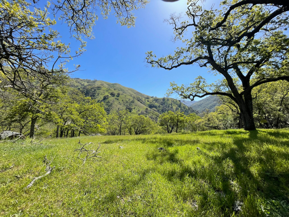


Oak dominated habitats, including oak woodlands, forests, and savannahs, have the greatest species richness of any vegetation type in California. Characterized by dominance of one or more of the nine native tree oaks of California, these habitats harbor more biodiversity than any other, supporting over 300 species of vertebrates, 5,000 invertebrates, and 2,000 plant species.
What metrics determine the health of this indicator?
Metric 1
The spatial extent (acres) of oak woodlands within each of the sub-regions, across the area of focus is maintained.
Unknown
Unknown
Low Metric 1
The spatial extent (acres) of oak woodlands within each of the sub-regions, across the area of focus is maintained.
Condition Thresholds
Good
Maintain or increase the spatial extent of oak woodlands within the area of focus, measured based upon aerial cover of all woodland types combined as well as individually by alliance, within any of the area of focus subregions.
Caution
Decrease in the spatial extent of oak woodlands (as a whole and individually by alliance) within the area of focus, in each of the area of focus subregions.
Significant Concern
Declining trend in the spatial extent of oak woodlands (as a whole and individually by alliance) over a period of five years, within any of the subregions in the area of focus.
Metric Current Health Findings
Current Condition
Oak woodlands are currently distributed throughout the area of focus, and the five partner agencies manage nearly 70,000 acres of oak woodlands, based upon CLN mapping. With improvements in the resolution of future fine scale vegetation mapping in the area of focus, additional areas of oak woodland may be identified, and some currently mapped areas will be attributed more precisely.
Current Trend
Over the past 60 years, oak woodland area has diminished further in the area of focus, including major losses on the hillsides surrounding the valleys, from rangeland clearing for enhancement of forage production (Barbour et al. 2007, Allen-Diaz et al. 2007, Stanford et al. 2011). While residential sprawl development water diversions and development has permanently removed oak woodland habitat from the area of focus valley bottoms where sparse oak savannahs were cleared as early as the 1930s (Stanford et al. 2013), cleared rangelands adjacent to existing oak woodlands found on steeper slopes offer an opportunity to expand oak woodland extent in the area of focus. The spatial extent of this opportunity for expansion has not yet been quantified.
Current Confidence
A comprehensive baseline oak woodland coverage dataset is not available for the area of focus. A formal assessment of the baseline condition needs to be established before trends in oak woodland extent can be assessed.
Rationale - Why It's Important
The spatial extent of oak woodlands in the area of focus has changed dramatically since the arrival of Europeans. Oak woodlands are a valuable component of the area of focus for wildlife habitat (insect diversity, food for birds and small mammals), plant species, fungal diversity, water system regulation, and carbon storage. Understanding and tracking the spatial extent of oak woodlands is important as species are already responding to climate change through detectable changes in distribution (McLaughlin and Zavaleta 2012) and therefore the spatial extent of oak woodlands in the area of focus provides indications of potential habitat fragmentation and genetic bottlenecks as well as opportunities for species survival under uncertain climate conditions. This metric was developed to monitor health/resilience of oak woodlands with particular focus on the potential effects from utilities management, reservoir and water conveyance management, legacy and current land management (including rangeland management) and altered fire regimes.
Goal
Maintain the spatial extent (acres) of oak woodlands within each of the sub-regions, across the area of focus. This metric may be applied to track the spatial extent of oak woodlands overall, as well as the extent of individual oak woodland alliances within the area of focus. If desired, the data used to measure this metric could be further pulled apart to review the conditions of the oak woodland communities individually, across each subregion.
Baseline Description
Oak woodlands are currently distributed throughout the area of focus, and the five partner agencies manage approximately 68,962 acres of oak woodlands, based upon CLN mapping. Live oak woodland dominated by coast live oak is the dominant woodland type in the East Bay Hills subregion, blue oak woodland is the dominant woodland type in the Mt. Diablo Range subregion, and coast live oak woodland and blue oak woodland are co-dominant woodland types in the Mt. Hamilton subregion. Valley oak woodland is limited in the area of focus and found most commonly in the Mt. Hamilton subregion, with small, isolated patches in the Mt. Diablo Range subregion. The only examples of black oak woodland in the area of focus are found in drainages near San Pablo Dam Rd. in the North East Bay Hills Landscape unit. Two small areas of canyon live oak are mapped in the area of focus, one of which is in the Mt. Hamilton subregion and the other is in the Mt. Diablo Range subregion. It is anticipated that with improvements in the resolution of future fine scale vegetation mapping in the area of focus, additional areas of oak woodland may be identified, and some currently mapped areas will be attributed more precisely.
Metric 2
The current area (acres) of healthy, living oak woodland canopy in the area of focus is maintained or increases.
Unknown
Unknown
Low Metric 2
The current area (acres) of healthy, living oak woodland canopy in the area of focus is maintained or increases.
Condition Thresholds
Good
Maintain or increase the extent of healthy oak woodland canopy within existing oak woodlands.
Caution
Decrease in extent of healthy oak woodland canopy, within existing oak woodlands.
Significant Concern
Decreasing trend, year over year, in the extent of healthy oak woodland canopy within existing oak woodlands.
Metric Current Health Findings
Current Condition
Current condition is unknown, subject to future analyses.
Current Trend
Impacts of a recently introduced sudden oak death pathogen as well as increasingly severe patterns of drought and wetness have resulted in extensive reductions in oak woodland canopy throughout many portions of the area of focus.
Current Confidence
Unknown pending future analyses.
Rationale - Why It's Important
Healthy oak woodlands require a green, living canopy to satisfy the full range of ecosystem services they offer. The leafy canopy is not only the engine of growth for the tree, but also provides shade and shelter to wildlife and contributes to higher soil nutrient levels (Dahlgren et al. 2003). Therefore, oak woodlands with healthier canopies are an indication of oak woodland areas that support a higher diversity of plant, animal, and insect species. As such, changes in canopy health are indicators of shifts in important ecological processes, including tree mortality, reduced primary productivity, loss of tree-held carbon stores, and ecosystem degradation (Dwomoh et al. 2021).
Oak woodlands in the area of focus are currently threatened by a number of natural stressors, including but not limited to extensive drought-induced stress, insect pests, and disease. Non-native fungal pathogens, such as Phytopthera spp. which causes SOD, continue to pose a threat to live oaks. Both drought stress, insect pests, and fungal pathogens manifest a number of primary symptoms across all species, ultimately killing the host tree which results in a dead, brown canopy. Primary symptoms of canopy decline include, but are not limited to, foliar discoloration, crown thinning, and trunk and branch damage. Tracking trends in oak woodland canopy health is a good indicator of overall oak woodland resilience and health in the area of focus. This metric was developed initially to measure health/resilience of live oak woodlands with particular interest in the potential effects from invasive epidemic plant pathogens. Extensive drought in the area of focus has compounded the stress on all oaks, as have new introduced pathogens and pests, expanding the purpose of this metric to capture the effect of extreme climate events as well as invasive, epidemic plant pathogens on all oak woodland communities in the area of focus.
Goal
Maintain or increase the current area (acres) of healthy, living oak woodland canopy in the area of focus. Increases would occur in appropriate locations, including where oak trees have been lost and not at the expense of other high-quality habitat, to be determined in coordination with land managers and restoration specialists.
Baseline Description
Current baseline is unknown. Satellite/Aerial imagery can be used to assess canopy health (canopy density and/or discoloration) across the area of focus, once a fine scale vegetation map has been created and there is clear understanding of mapped oak woodland extent in the area of focus. The baseline data will allow us to determine potential associations between regions or species and canopy stress indicators. Canopy condition and health could be assessed following methods adapted from the United State Geological Survey (USGS) Land Change Monitoring, Assessment, and Projection (LCMAP) initiative, which offers various annual land-cover and land-surface change products for use in an analysis of tree cover and condition change over time (USGS 2023). Data availability and remote sensing techniques are improving rapidly around vegetation change detection; therefore, this metric would be measured using best available techniques and tools at the time of sampling. The condition goal and thresholds will be refined (if needed) once the unit of analysis is established for this metric.
Metric 3
Recruitment of viable saplings (including stump sprouts) in blue oak woodlands and valley oak woodlands increases to support regeneration of the blue and valley oak overstory over time.
Unknown
Unknown
Low Metric 3
Recruitment of viable saplings (including stump sprouts) in blue oak woodlands and valley oak woodlands increases to support regeneration of the blue and valley oak overstory over time.
Condition Thresholds
Good
The abundance (number) of viable saplings is consistent or increasing in the area of focus.
Caution
The abundance (number) of viable saplings is decreasing in the area of focus.
Significant Concern
A declining trend in abundance (number) of viable saplings, year-over-year in the area of focus.
Metric Current Health Findings
Current Condition
Unknown pending future analyses.
Current Trend
Unknown pending future analyses.
Current Confidence
Unknown pending future analyses.
Rationale - Why It's Important
Oaks are long-lived species; however, healthy white oak woodlands still require recruitment of saplings into the overstory in adequate numbers to support the replacement of dead or dying oaks. Sapling recruitment is suspected by scientists and managers to be the bottleneck in oak replacement, particularly in the white oak group. This metric was developed to monitor health/resilience of oak woodlands with particular interest in the potential effects from land management such as incompatible grazing practices and dry land farming, as well as from non-native and invasive plant and wildlife species, and altered fire regimes.
Goal
Increase recruitment of viable saplings (including stump sprouts) in blue oak woodlands and valley oak woodlands, to support regeneration (replacement of individuals lost from mortality) of the blue oak and valley oak overstory over time.
Baseline Description
A survey of studies across the state indicates that both blue oak and valley oak show very limited graduation of seedlings into the sapling class (sapling recruitment) at present; however, studies are limited and none of them are from the area of focus (Tyler et al. 2006). Although blue oak and valley oak sapling recruitment patterns are not documented for the area of focus there is some concern that levels are below the desired rate of recruitment to support persistence of existing blue oak and valley oak woodland coverage in the area of focus, but data is needed to determine the baseline condition.
About this Indicator
Oak dominated habitats, including oak woodlands, forests, and savannahs, have the greatest species richness of any vegetation type in California (Allen-Diaz et al. 2007). Characterized by dominance of one or more of the nine native tree oaks of California, these habitats harbor more biodiversity than any other, supporting over 300 species of vertebrates, 5,000 invertebrates, and 2,000 plant species (Barrett 1980, Zack et al. 2005, Verner 1980, UCANR 2019).
Why is This Resource Included?
Oak woodlands are considered one of the most productive habitat types in California, providing a myriad of benefits and services that support wildlife, insects, plants, soil stability, water quality, and recreation. Oak trees define these communities acting as “foundation species,” defined by Ellison et al. (2005) as species that control population and community dynamics and modulate ecosystem processes. Oak habitat in the area of focus grows predominantly as woodlands, which provide specific services to human society such as rangeland forage and recreation (Davis et al. 2016), as well as research opportunities as ecosystem indicators for climate change and forest disease (McLaughlin et al. 2014, McPherson et al. 2015). For these reasons, oak woodlands are included as an indicator of ecosystem health for the area of focus.
Desired Condition and Trend
The desired condition and trend for oak woodlands is to maintain or increase the current spatial extent, persistence, and health of oak woodlands in the area of focus. Healthy oak woodlands exhibit healthy crowns (free of sudden oak death [SOD] and other pathogen stressors), recruitment success that supports the replacement of dead/dying trees, and spatial extent on the landscape that supports genetic diversity and resilience in a rapidly changing climate.
Current Condition and Trend
The existing current and historical data on distribution and extent of oak woodlands is insufficient to allow an evaluation of current indicator condition and trend, and so condition, trend and confidence in oak woodland health is not certain across the area of focus. Limited studies in small areas throughout the area of focus tend to confirm regional concern that oak woodlands are facing threats from changing climate and invasive epidemic pathogens, putting stress on the woodland communities; however, given historic changes in the composition of oak woodlands on the landscape, a wide-ranging regional approach to examining trends in oak woodland health and distribution is needed to determine the effect and severity of stressors on this indicator.
Stressors
Climate Change
Increases in the severity and frequency of drought, flooding, extreme temperatures, rainfall, etc. may affect the composition and distribution of oak woodland communities.
Direct Human Impacts
Direct human impacts include both historical and current impacts, including and natural resources use, including legacy woodcutting, legacy and current mining, dryland farming, infrastructure development and incompatible grazing practices may alter the composition and extent of oak woodlands through land use conversion (Lopez-Sanchez et al. 2014). New infrastructure such as the development of new transmission lines, buildings, parking lots, trails, roads may result in permanent oak woodland habitat loss.
Fire Regime Change
Altered fire regimes may change the composition and extent of oak woodlands depending upon the severity, extent and intensity of the altered regime.
Indirect Human Impacts
Infrastructure protection and maintenance efforts within the area of focus (i.e. removal of trees around power lines and buildings) and discing and mowing for fire protection may affect tree health and seedling survival by disturbing the ground surface within oak woodlands and/or removing branches and weakening individual trees.
Invasive Species Impacts
Invasive epidemic plant pathogens such as (Phytophthora ramorum) that causes SOD and other pests may affect the health and viability of oak woodlands. In addition, non-native and invasive plant and wildlife species may reduce oak woodland health and viability (Sweitzer and Van Vuren 2002).
Additional Resources
Other Metrics Considered but Not Included
- Native Plant Species Richness in Understory of Oak Woodlands. Metric was eliminated due to lack of data and complexity of establishing a baseline and then performing adequate regular monitoring with limited resources.
- Patch Size and Patch Distribution of Valley, Blue, and Coast Live Oak Woodlands. Metric was eliminated due to lack of clear scientific consensus on ideal or desired patch size and distribution in the two species and a lack of consensus on the appropriate way to measure the metric to reach a meaningful conclusion. In the future, if more research on the topic is published, we recommend considering the addition of a metric that looks at the size and distribution of oak woodland stands (patches) in the area of focus and how change over time indicates changes in oak woodland health.
Data Gaps and Data Collection/Management Needs
Metric 1: Spatial Extent of Oak Woodland Vegetation Communities
- Historic records of oak woodland distribution across the area of focus are largely qualitative and descriptive, with limited spatial data that is largely restricted to hand drawn maps. These historic datasets are problematic for use in trend analysis because they are incomplete and use incompatible mapping standards.
- The data source for current vegetation mapping in the area of focus, made available within CLN 2.0, is the USFS Calveg existing vegetation (EVeg) dataset with 5-meter spatial resolution and based on imagery dated between 1997 and 2001 (USFS 2023, BAOSC 2019). The mapping resolution is variable and coarse, and the acreage calculations and analyses based upon this dataset carry the limitations of relying on mid-resolution satellite imagery to derive fine-scale changes in oak woodland community boundaries.
- A systematic effort to map vegetation communities across the area of focus is critical to the success and utility of this metric. Specifically, oak woodland mapping should be refined so that the minimum mapping unit (MMU) is consistent across the area of focus (1 acre or less) and the classification scheme is based on the Manual of California Vegetation (MCV) or another suitable classification system. A fine-scale vegetation map for the region is currently underway and will apply an MMU for oak woodland alliances equal to 1-acre. Contrasting life forms within the oak woodland alliances will be captured at the ½-acre MMU (Dina Robertson, personal communication).
Metric 2: Acres of Healthy Oak Woodland Canopy
- Current vegetation mapping in the area of focus lacks significant ground-truthing and presents data at various spatial resolutions, as described above. In addition, the spatial resolution available in the CLN dataset is not refined enough to establish existing extent of various oak woodland community types, which is a needed baseline for an analysis of changes in canopy health over time. Development of a fine-scale vegetation map for the area of focus will support this metric by standardizing the baseline unit of analysis and the spatial distribution of the different oak woodland communities.
- Once a mapping and classification effort in area of focus has been finalized, collection of appropriately timed aerial imagery or remote sensed data on recurring intervals will be needed to allow detection of changes in canopy condition that reflect changes in tree health rather than seasonal variations in leaf expansion, color, and presence. The timing and return interval of data collection would need to be set individually for each oak woodland community, based upon unique leaf phenology. At a minimum each oak woodland community would need to be sampled annually to effectively identify changes in canopy health. Remote sensing techniques using aerial imagery and processes to detect changes on the landscape (i.e. the normalized difference vegetation index [NDVI] using near infrared wavelengths) are advancing our ability to detect near-term changes in landscape and vegetation community condition and in combination with the forthcoming fine-sale vegetation map, this remote sensing index, as well as others in development, may allow increasingly fine-scale detection of canopy conditions.
Metric 3: Viability of Blue Oak and Valley Oak Sapling Recruitment
- There are no comprehensive long-term / multi-year studies to track the long- term outlook for blue oak and valley oak sapling presence, distribution, and therefore recruitment in the area of focus; however, the SFPUC performed a study in 2011 that provided a snapshot of oak recruitment within the area of focus with reference to stressors and historical recruitment levels extrapolated from historic aerial imagery (URS and SFPUC 2013). Study plots suitable for Metric 3 therefore exist on SFPUC lands within the area of focus but not on land outside SFPUC ownership.
- Blue oak and valley oak sapling plots would need to be established in the remaining portions of the area of focus, based upon the results of fine-scale vegetation mapping effort combined with field observation in the non-SFPUC portions of the area of focus.
- The plot-based oak sapling monitoring would need to occur annually, at multiple locations per species, ideally representing a range of geographic, edaphic, and land use histories, where available. The number and location of plots selected for regular monitoring may vary by agency availability and funding.
Past and Current Management
Past and current oak woodland monitoring in the area of focus is largely informed by long-term management plans prepared by Network partners to address site-specific concerns. The type and frequency of oak woodland monitoring and management activities varies between Network partners based on a host of factors, notably management priorities and available resources. Some of the Network partners employ monitoring-based adaptive management approaches that allow for up-to-date research and monitoring results to inform management decisions based on specific goals and objectives. In some cases, monitoring and subsequent management decisions are driven by observed changes in oak woodland health (i.e. riparian oak recruitment studies, planting, and monitoring on SFPUC property and SOD monitoring and study on EBRPD lands [McPherson et al. 2015]), and in other cases management decisions are driven by stochastic events and associated response protocols (ex. removal of fire-damaged, hazard trees on EBRPD lands after a wildfire event).
EBRPD is currently leading a fine scale vegetation classification and mapping effort covering Alameda and Contra Costa Counties, applying the most current CNPS and CDFW vegetation classification and mapping protocols. The effort is anticipated to conclude in 2025. This effort will directly inform future iterations of this worksheet, as well as management decisions and Nature Check planning.
Potential Future Actions
- Utilize anticipated fine-scale vegetation map to establish baseline conditions for oak woodland extent and canopy health.
- Develop change detection methodology for measuring Metrics 1 and 2, using multitemporal image classification (with the harmonized Landsat and Sentinal-2 [HLS] or a similar imagery product) to consider where changes in oak woodland extent and condition are occurring and using high resolution imagery (NAIP or similar) to characterize what kind of change is occurring (i.e., foliar change, trunk mortality, canopy expansion, etc.).
- Utilize anticipated fine-scale vegetation map to prioritize blue oak and valley oak areas that are suitable for collecting blue oak and valley oak sapling baseline data and establishing long-term recruitment monitoring plots.
- Develop a consistent set of long-term monitoring methods and protocols across Network partners
Key Literature and Data Sources
For additional information about this indicator including key literature and data sources see Oak Woodlands Indicator NatureCheck Report