Mesocarnivores
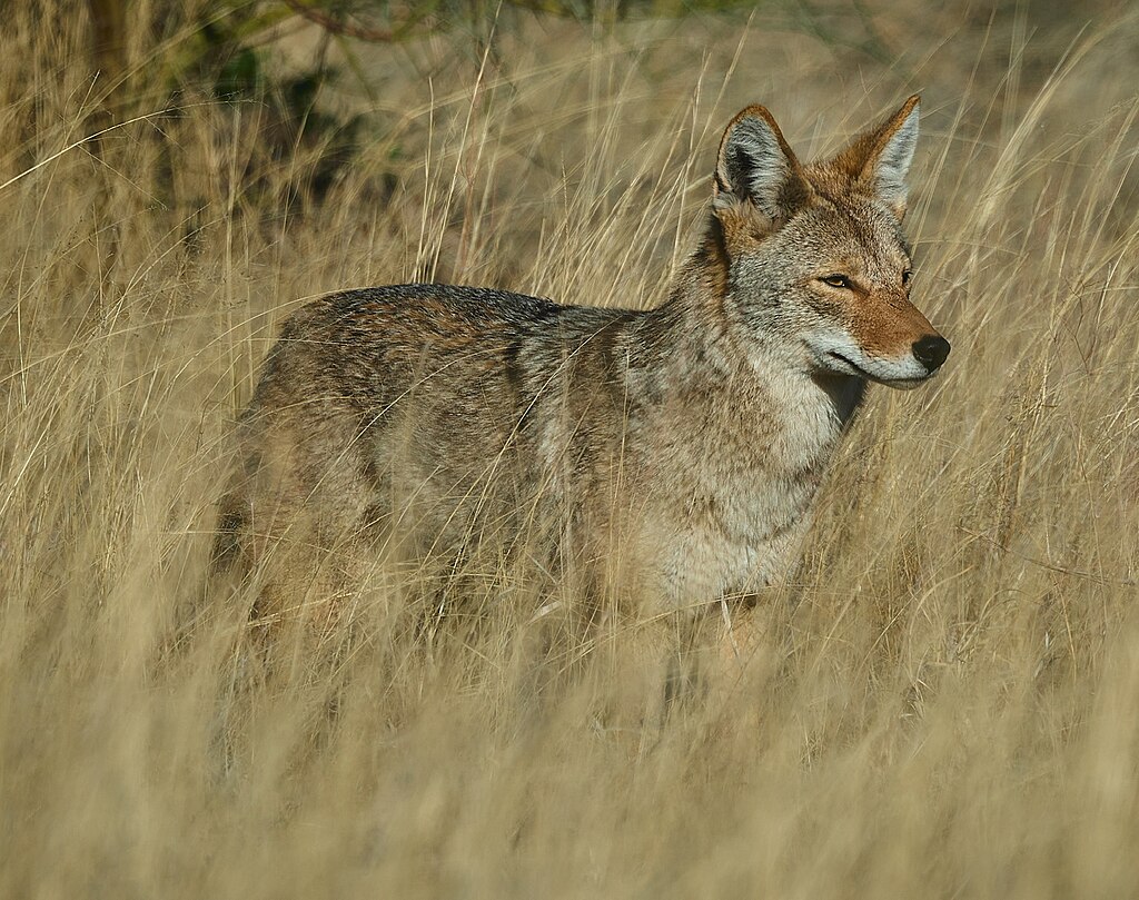


Mesocarnivores are medium-sized terrestrial mammals that primarily eat live prey and can be considered as proxies for overall ecosystem stability and integrity. Both relatively common species like coyotes and rarer species like the American badger were included in this analysis.
What metrics determine the health of this indicator?
Metric 1
Bobcat, coyote, and gray fox are documented in monitored Network partner lands for each subregion annually.
 Good
Unchanging
Moderate
Good
Unchanging
Moderate Metric 1
Bobcat, coyote, and gray fox are documented in monitored Network partner lands for each subregion annually.
Geographic Area
Condition Thresholds
Good
Mesocarnivores (bobcat, coyote, gray fox) are present in 50% or more of monitored parks and/or land units in each subregion in Network partner lands. These species show stable or increasing presence in monitored parks and land units in each subregion of Network partner lands. (An increase or decrease in coyote presence [percentage of parks with detections] should be assessed relative to the other mesocarnivores.)
Caution
Common mesocarnivores are present in less than 50% of monitored parks or land units in each subregion of Network partner lands. The proportion of monitored areas on Network partner lands where common mesocarnivores were previously present decreases more than 30% in any subregion within a three-year period for one or more of the three common species. For example, if 50% of monitored parks in any one subregion recorded gray fox and bobcat present, but then the proportion of occupied parks decreased to 10% for gray fox and 20% for bobcat in a subsequent year, the condition threshold would be caution.
Significant Concern
Common mesocarnivores are present in less than 20% of monitored Network partner lands in each subregion. The proportion of monitored areas on Network partner lands where common mesocarnivores were previously present declines more than 60% within any one subregion in a three-year period for one or more of the three common species.
Metric Current Health Findings
Current Condition
The current health condition is Good based on an average of
- Bobcat: Good (All subregions)
- Coyote: Good (All subregions)
- Gray fox: Good (East Bay Hills, Mt. Hamilton), Caution (Mt. Diablo Range). The gray fox was detected in three of nine monitored parks in the Mt. Diablo subregion.
Current Trend
Detection history shows consistent detections from monitored parks with multiple years (time series); in this case, we have data to support our finding that the trend for this metric is Unchanging.
Current Confidence
The confidence assessment is Moderate. Monitoring data were recent and reliable but not comprehensive in their coverage of the Network partner lands in each subregion. Network partners provided records from camera traps studies and from the EBMUD mammal database, which were aggregated and used as the basis for this metric.
Rationale - Why It's Important
The presence of this suite of common mesocarnivore species (bobcat, coyote, and gray fox) is a sign of overall ecosystem productivity. Therefore, a way to measure ecological health is to see if Network partner lands are supporting these species and if they are detected annually.
Goal
Bobcat, coyote and gray fox are documented within monitored Network partner lands for each subregion annually.
Baseline Description
Bobcat, coyote, and gray fox were detected in each subregion but not in all Network partner lands and not in all years (total detections for the area of focus included 3,756 bobcat records, 15,061 coyote records, and 2,260 gray fox records). We did not use tallied totals to determine abundance or trend because we could not standardize the findings by unit effort (number of detections per unit effort [trap nights]); instead, we converted these “total detections” to a 1 (detection) for the unit or park in which it was recorded.
Metric 2
Breeding for three common mesocarnivores (bobcat, coyote, gray fox) occurs in the majority of Network partner lands in each subregion within the area of focus, as measured in five-year intervals.
 Unknown
  Unknown
  Low
Low Metric 2
Breeding for three common mesocarnivores (bobcat, coyote, gray fox) occurs in the majority of Network partner lands in each subregion within the area of focus, as measured in five-year intervals.
Geographic Area
Condition Thresholds
Good
Young of the three common mesocarnivores are documented in more than 50% of monitored Network partner lands in the area of focus within a five-year period.
Caution
Young of the three common mesocarnivores are documented in 50% or fewer of monitored Network partner lands in the area of focus within a five-year period.
Significant Concern
Young of only one or two of the three common mesocarnivores are documented in any one subregion of the area of focus within a five-year period.
Metric Current Health Findings
Current Condition
The condition is Unknown at this time due to lack of photo evidence of young common mesocarnivores. Camera trapping is a suitable method of documenting mesocarnivore breeding, but previous studies did not record age class.
Current Trend
The trend is Unknown at this time due to lack of photo evidence of young common mesocarnivores.
Current Confidence
The confidence is Low at this time due to lack of photo evidence of young common mesocarnivores.
Rationale - Why It's Important
Breeding (i.e., the presence of young) indicates that the habitat can support potential source populations of common mesocarnivores on Network partner lands and the surrounding landscape in the area of focus. It also indicates that these Network partner lands are likely not functioning as population sinks. For the ecosystem to remain healthy and resilient, successful breeding ensures presence over time, whether individuals can immigrate from other areas.
Goal
Breeding in the three common mesocarnivores occurs in the majority of Network partner lands in each subregion within the area of focus, as measured in five-year intervals.
Baseline Description
The Current Condition is unknown because the aggregated camera data and EBMUD mammal database yielded no records of young (documentation) to indicate that breeding is occurring. However, because young animals were likely not identified as such (e.g., as young or juveniles) when images were categorized (processed), this lack of records is presumed to be an artifact of the way the data were processed, not necessarily an indication that no young were present. Camera trapping is a suitable method of capturing mesocarnivore breeding events. Records from recently implemented camera trapping studies as well as unprocessed images from past camera efforts should provide baseline data for this metric in the future, as instances of young will be noted and recorded during image processing.
Metric 3
Rare mesocarnivores (badger, long-tailed weasel, spotted skunk, ringtail) are detected in each subregion in five-year intervals.
Caution
Unchanging
Low Metric 3
Rare mesocarnivores (badger, long-tailed weasel, spotted skunk, ringtail) are detected in each subregion in five-year intervals.
Geographic Area

Condition Thresholds
Good
Each rare species is documented within each subregion at least once in each five-year period.
Caution
Each rare species is documented within the area of focus but not in each subregion in a five-year period.
Significant Concern
None of the rare species is documented within the area of focus in a five-year period.
Metric Current Health Findings
Current Condition
The current health condition for Metric 3 is Caution based on an average of:
- Badger: Good (all subregions). The badger was detected in all subregions, so it met the threshold for “good.”
- Long-tailed weasel: Good (East Bay Hills, Mt. Diablo Range), Significant Concern (Mt. Hamilton). The long-tailed weasel was detected in the East Bay Hills in 2018 (within five years of this analysis) and from a record in the Mt. Diablo Range subregion (2018), which meets the “good” threshold. The long-tailed weasel was not detected in the Mt. Hamilton region making it “significant concern” for this subregion.
- Western spotted skunk: Good (Mt. Diablo Range), Significant Concern (East Bay Hills, Mt. Hamilton). The western spotted skunk was detected in the Mt. Diablo Range subregion (2018), meeting the “good” threshold.
- Ringtail: Significant Concern (all subregions). The ringtail record from the East Bay Hills subregion is more than five years old (from 1997), and this puts it in the “significant concern “condition.
Current Trend
The current health trend for Metric 3 is Unchanging based on an average of:
- Badger: Unchanging (all subregions). The badger was detected in 2020 in monitored parks where they had been detected previously; in no case was a badger not detected in a monitored park within Network partner
lands where it had been detected previously. - Long-tailed weasel, western spotted skunk, ringtail: Unknown (all subregions). Observations for these species were not associated with a time series of other detections, so we were not able to determine a trend, such as consistent presence in five-year increments.
Current Confidence
The confidence in Metric 3 is Low based on an average of:
- Badger: Moderate (all subregions). Monitoring data were recent and reliable but not did not comprehensively cover Network partner lands in each subregion.
- Long-tailed weasel, western spotted skunk, ringtail: Low (all subregions) Monitoring was insufficient in terms of its comprehensiveness, both in time and space.
Rationale - Why It's Important
Healthy ecosystems support the entire suite of expected mesocarnivores, including rare species. Therefore, documenting rare species in each subregion within a five-year period (the past five years and within each five-year period moving forward) would reveal something about how intact these ecosystems are and might indicate the presence of the unique ecological niches necessary to maintain populations of relatively rare mesocarnivores.
Goal
Rare mesocarnivores are detected in each subregion within five years.
Baseline Description
The badger was detected in each subregion and eight of 18 Network partner lands (44%), based on camera monitoring data and EBMUD records. This includes one of five Network partner lands in the East Bay Hills (20%), five of nine (56%) in the Mt. Diablo Range, and two of four (50%) in Mt. Hamilton.
About this Indicator
This ecological health indicator includes a suite of medium-sized, carnivorous mammal species (mesocarnivores) that are bellwethers of ecosystem health. Mesocarnivores in general are indicators of ecosystem productivity and can be used as proxies for overall ecosystem stability and integrity. The species selected for this indicator include common species [bobcat (Lynx rufus), coyote (Canis latrans) and gray fox (Urocyon cinereoargenteus)] and rare species [(ringtail (Bassariscus astutus), spotted skunk (Spilogale gracilis), long-tailed weasel (Mustela frenata) and American badger (Taxidea taxus)]. Together, this suite of species rely on a variety of habitats including grasslands, brush, and forests. Badgers, in particular, are a strong indicator of grassland health and habitat connectivity because they require large, connected patches of healthy grasslands and xeric landscapes with sufficient prey. The presence of both common and rare species also indicates an intact community (that is, one that has its constituent members).
We used three metrics to evaluate mesocarnivore condition and trends: The presence of common species (Metric 1), breeding for these common species (Metric 2), and the presence of rare species (Metric 3). We assessed these metrics using records from Network partner agency monitoring efforts and the East Bay Municipal Utility District (EBMUD) mammal database from 2012 until 2020 covering different subregions of East Bay Stewardship Network (Network) lands within the area of focus. Data came from individual parks, reservoirs, recreation or management areas, and other open spaces (land units and parks) that we also refer to as “Network partner lands” throughout this chapter.
What we learned reveals that the overall condition is “caution”, and the trend is “unchanging.” Metric 1 indicated that the condition of all common species was “good”, and the trend was “unchanging. Because Metric 2 was data deficient, we could not determine a condition or trend at this time. Finally, Metric 3 for rare species showed mixed results. For example, the ringtail’s condition was “significant concern” for all subregions. However, the badger was in good condition with an unchanging trend in all subregions. Long-tailed weasels were in good condition in the East Bay Hills and Mt. Diablo Range subregions but of significant concern in the Mt. Hamilton subregion. The western spotted skunk was in good condition for the Mt. Diablo Range subregion but of significant concern for the East Bay Hills and Mt. Hamilton subregions. It is important to note that these individual species’ conditions and trends were averaged to arrive at the overall score for each subregion. We recognize that this methodology obscures some of these nuances among the species in each subregion.
Given the constraint of using only existing data, the evaluation also identified areas where not enough is known to draw meaningful conclusions and opportunities for future research and collaboration among land managers. There are past camera data that have not yet been analyzed and may provide evidence of breeding (images of young). Moving forward, the review and processing of ongoing camera data will provide needed additional records. These records will create a time series over a larger proportion of the area of focus, so our findings can be sufficiently comprehensive. Common mesocarnivore abundance metrics (assessed through occupancy and detection rates) and rare mesocarnivore distribution records over a longer timeframe will help us assess current conditions. Trend assessments will then allow us to understand if local mesocarnivore populations are stable or declining. A primary goal of the analysis was to provide a benchmark against which managers can measure future changes and understand the likely trajectory of these species. Data gaps are described at the end of this chapter and identify where we can focus future work to best manage ecosystem health.
Why is This Resource Included?
The presence, abundance, and population stability of mesocarnivores, both common and rare, are indicators of a healthy ecosystem and can be used as proxies for overall ecosystem stability and integrity. Mesocarnivores are indicators of functional connectivity for medium-sized terrestrial species. Common mesocarnivores indicate the overall productivity of an ecosystem, and rare ones can indicate the presence of the unique niches associated with maintaining their presence. Determining the status of the rarest and least-known of our carnivore species that may be on the brink of, or already have become, extirpated is also key in assessing the health of East Bay ecosystems. Of the rare mesocarnivores, the American badger (Taxidea taxus) is a California species of special concern, and the ringtail (Bassariscus astutus) is a California fully protected species. The spotted skunk (Spilogale gracilis), ringtail and long-tailed weasel (Mustela frenata) remain data deficient and their current status, distribution, and population trends are unknown; however, they are members of this community and thereby represent “intactness.” We hope to have a better understanding of their current status by including them here.
It is also important to include a suite of mesocarnivores because no single dominant species can indicate a stable community structure. This is evidenced by mesocarnivore release (when one species becomes abundant relative to the others), which can occur in the absence of top trophic-level carnivores. Including a suite of mesocarnivores also represents a variety of habitats. The bobcat (Lynx rufus) prefers open areas, brush, and moderate canopy forests. The gray fox (Urocyon cinereoargenteus) is considered arboreal but also uses a variety of other habitats. The coyote (Canis latrans), badger, and long-tailed weasel require grasslands and prefer open habitats. These common mesocarnivore species (bobcat, coyote, gray fox) indicate overall ecosystem productivity, while the rare species (badger, ringtail, long-tailed weasel, spotted skunk) can indicate the presence of the unique ecological niches necessary to maintain their populations.
Desired Condition and Trend
Common species (bobcat, coyote, gray fox): Common species are present in the habitats where they are expected to occur, and their abundance is stable or increasing within monitored Network partner lands in each subregion.
Rare species (badger, ringtail, long-tailed weasel, spotted skunk): The presence of each rare species within each subregion is documented every five years.
Current Condition and Trend
Common species (bobcat, coyote, and gray fox) were detected in each subregion of monitored Network partner lands in the area of focus between 2012 and 2020. These species are considered present in many of the parks and lands throughout the area of focus; however, we do not know if their populations are stable, declining, or increasing.
Rare species:
- The badger was detected in 2020 on monitored Network partner lands in each subregion where it had been previously detected. This shows that at least in these lands, the badger is present (good condition). How widespread the badger currently is in the area of focus and the stability of its populations are not known.
- The ringtail was detected more than five years ago (1997) in the East Bay Hills subregion.
- The long-tailed weasel was detected within the past five years (2018) in the East Bay Hills subregion and in the Mt. Diablo Range.
- The spotted skunk was detected in the Mt. Diablo subregion.
This overall condition, trend, and confidence is the average of the condition, trend, and confidence for common mesocarnivore species in each subregion. The metrics were combined to obtain this current condition, trend, and confidence. They give us a way to measure the difference between what is described in this section (i.e., how things are now) and the desired condition and trend described in the preceding section (i.e., what we think “healthy” is for this indicator).
Stressors
Climate Change
Loss of habitat due to wildfire and habitat degradation due to drought conditions are likely to be both directly and indirectly affecting mesocarnivore populations on Network partner lands and nearby areas.
Direct Human Impacts
While hunting is prohibited on all Network partner lands, fur trapping on adjacent lands continues to threaten these mesocarnivores. All species, except the ringtail, have bag limits during certain times of the year. Coyotes can be legally shot or poisoned at will, and depredation permits are issued for gray fox and bobcat for taking livestock including chickens. Badgers can also be taken under the California Fish and Game Code. Exposure to human activity can affect foraging, breeding, and raising young for these shy carnivores. Mesocarnivores, particularly the badger, are subject to road mortality.
Habitat Disturbance/Conversion/Loss
Loss of habitat and connectivity through land-use change (including roads and highways) has affected mesocarnivore species by decreasing the ability of these species to disperse and breed.
Historical Impacts
Fur trapping, hunting and predator control programs affected all mesocarnivores, most notably the coyote but also, the bobcat and gray fox.
Pollution/Contaminants
Exposure to rodenticides is considered to have deleterious effects on mesocarnivores both by direct mortality (e.g., from ingestion of poisoned prey) and indirect mortality (e.g., from long-term exposure to poisoned prey, leading to ill health, liver damage, and decreased immune function).
Additional Resources
Other Metrics Considered but Not Included
Additional metrics were considered for evaluating the American badger including breeding and habitat suitability and connectivity. However, these metrics are data deficient and we lacked the information necessary to evaluate them. More information on grassland suitability will be evaluated as part of the California ground squirrel indicator and in the overall vegetation health of the area of focus.
Data, Management, and Supporting Information
Data Gaps and Data Collection/Management Needs
- Some Network partner lands were not monitored, so no Network partner agency data were available to evaluate species presence/absence in those areas.
- Common species were not recorded in a systematic manner, making it impossible to get an accurate assessment of abundance for areas monitored using camera traps.
- The lack of a central database precluded timely data analysis, as data acquisition required a high level of effort (e.g., information recorded in reports required pulling data from Microsoft Word tables).
- The lack of useful metadata (e.g., data record location, date, time, and level of survey effort) precluded useful analyses in some instances.
- Unprocessed data (uncatalogued images and siloed raw data) were not available for this assessment.
- The lack of systematic surveys across each subregion means we do not have useful real-time baselines upon which to measure change.
Past and Current Management
Monitoring for species such as the San Joaquin kit fox and puma have incidentally recorded other carnivores as well as other studies explicitly included carnivores as the target species, which provided the records used for this analysis. From these and other efforts, ten camera studies conducted by Network partners were identified as potentially able to provide information for this ecological health assessment; these efforts included 299 camera locations in the area of focus (71 in the East Bay Hills subregion, 75 in the Mt. Diablo subregion, and 144 in the Mt. Hamilton subregion). Of these, six, plus the EBMUD mammal database, provided records used for this data assembly effort. These six studies included 48 cameras in the East Bay Hills subregion (2016–2020), 31 in the Mt. Diablo Range subregion (2017–2020), and 54 in the Mt. Hamilton subregion (2012–2020).
Current studies that were identified but did not contribute records to the analysis for this chapter include post-fire monitoring (Mt. Diablo Range subregion) and a puma study (East Bay Hills and Mt. Hamilton subregions). Data from these projects will help illuminate future species-specific occupancy for target mesocarnivores and document breeding, as well as provide evidence of the four rare mesocarnivores, should they be detected. This will give us more information and allow us to set baselines and current conditions as well as to assess trends over time. Current and ongoing camera trapping projects (e.g., CCWD’s kit fox monitoring and the California State Parks (CSP) Large Mammal Occupancy Study at CSVRA) will also continue to provide data that may inform trends, reveal presence/absence, and document young for future updates to this chapter.
Also, additional unprocessed images from camera studies included here could be used in future updates. These include EBMUD ad hoc cameras (six), EBRPD carnivore research (Sunol-Ohlone, 2018-2020), CCWD San Joaquin kit fox monitoring (prior to and after 2017), and CSP CSVRA camera records (2014–2016) to update the baseline condition assessments and provide findings to assess trends (are conditions improving or declining, for example).
Sensor coverage for the Post-Fire Monitoring Study including audio recorders (AudioMoths, results not included in this analysis) will yield audio files for coyotes, which could serve as an additional source of data to assess coyote presence and activity.
Potential Future Actions
- Implement metadata standards and survey protocols to improve data quality and its usefulness in the evaluation of current conditions.
- Pursue adequate survey coverage to fill data gaps in survey efforts for each subregion and to improve confidence in establishing baseline conditions.
- Process unprocessed data and centralize data access to leverage efforts toward establishing current conditions with high confidence.
- Aggregate and then incorporate additional Network partner resources for some species in future assessments (e.g., the long-tailed weasel, which could be available in the Alameda whipsnake survey reports [T. Lim, personal communication, 2019]).
- Locate additional sources for mesocarnivore data records (e.g., the Eastern Contra Costa County Habitat Conservation Plan).
Key Literature and Data Sources
For additional information about this indicator including key literature and data sources see NatureCheck