California Tiger Salamander (Ambystoma californiense)
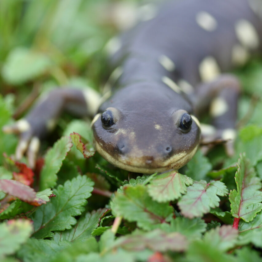


The California tiger salamander (CTS) is a federally threatened species found throughout much of the state. Adults live most of their lives underground in mammal burrows, but breed in ponds where their larvae swim until they mature and become terrestrial.
What metrics determine the health of this indicator?
Metric 1
Proportion of suitable wetlands and ponds where any life stage of CTS has been documented to be present in the last 10 years.
 Caution
Declining
Moderate
Caution
Declining
Moderate Metric 1
Proportion of suitable wetlands and ponds where any life stage of CTS has been documented to be present in the last 10 years.
Geographic Area
Condition Thresholds
Good
The number of CTS-occupied ponds in the area of focus is maintained, increased, or declines by up to 10% in the next 10 years.
Caution
The number of CTS-occupied ponds in the area of focus declines 10%-20% over the next 10 years.
Significant Concern
The number of CTS-occupied ponds in the area of focus declines over 20% over 10 years.
Metric Current Health Findings
Current Condition
Though the CTS is widely distributed across the Mt. Diablo Range and Mt. Hamilton subregions, the evidence of decline shown in the trends assessment is reason for concern. Current condition for all subregions is Caution.
Current Trend
Current trend is Declining. In the past 10 years, the number of sites considered as potential habitat increased slightly (from 378 to 385) due to the loss of invasive fish, which declined during the 2012–2017 drought. The number of sites where the CTS was detected varied highly across years, which is not unusual for this species. The lowest annual proportion of sites at which the CTS was observed was in 2014, when they were found at only two of 90 surveyed sites in the Mt. Diablo subregion and one of 37 surveyed sites in the Mt. Hamilton subregion. This corresponded with the most severe year of drought and the loss of many temporary breeding sites.
In the years following drought (2015–2017), the CTS appeared to rebound to pre-drought levels, with 62 of 117 surveyed ponds (53%) in the Mt. Diablo Range subregion and 31 of 57 surveyed ponds (54%) in the Mt. Hamilton subregion. In recent years, and despite a wet 2018–2019 water year, CTS occupancy appeared to decline again in 2017–2019, with the species occurring at 30 of 126 (23%) surveyed ponds in the Mt. Diablo Range subregion and 2 of 28 (7%) in Mt. Hamilton subregion. Occupancy in the East Bay Hills subregion remained low throughout the decade, with the CTS observed at only one pond in Vargas Plateau, and a single individual at Las Trampas (an EBRPD property).
We evaluated the statistical significance of trends in CTS occurrence by using generalized linear mixed models on a subset of 150 ponds that had been surveyed at least five times across the decade, were within the species’ range, and did not have fish. These models estimated that the proportion of ponds occupied by the CTS in the Mt. Diablo Range subregion had decreased significantly, from an estimated mean of 36% in 2009–2011 to an estimated mean of 18% in 2018–2019 (P = 0.005). In the Mt. Hamilton subregion, the estimated proportion of ponds occupied by the CTS declined from 35% in 2009–2011 to 10% in 2018–2019. However, the sample size was small in recent years, and the decline was only marginally significant (P = 0.06).
Current Confidence
Presence of pond habitat: Moderate.
We defined sites as potential CTS habitat if they did not contain invasive fish and were within the CTS’s range as analyzed (maximum extent of known observations). However, it was difficult to ascertain if a site did not contain fish or if fish were simply not recorded. Moreover, we were not able to use other variables known to be important to the CTS (e.g., hydroperiod, water quality, and pond size) to define suitability because these data were not available in sufficient detail throughout the area of focus. Stokes et al. (2021) found that preserves in Sonoma County with CTS breeding pools that “held water for at least two months following the breeding season (into late April) even in dry years had substantially lower rates of larval decline.” Ponds that dry during summer often support CTS breeding, although they may not be suitable for breeding in drier years.
Trend in occupied sites: Moderate.
Sampling was not consistent across properties, so the sites surveyed in recent years were not the same as those surveyed in earlier years. Estimates did not account for variation in survey effort across time, or detection probability, which can be low for this species (Moss et al. 2020, Joseph et al. 2016). Because the CTS shows high interannual variation in breeding activity, more consistent data across time or the use of more sophisticated modeling approaches (e.g., occupancy modeling) will help disentangle variation in sampling effort from trends in CTS occurrence. Additional data from the Mt. Hamilton subregion are needed; very few sites were surveyed in the most recent three years. Despite data gaps, strong evidence of widespread CTS increase or decrease is not apparent; rather, using statistical models, the trend was negative and highly variable.
Rationale - Why It's Important
This metric is defined as the proportion of ponds where any CTS life stage has been documented within the species’ current range in the area of focus over the last 10 years. We only considered sites defined as ponds rather than as lakes, streams, or seeps. While we considered all life CTS stages in this metric, larval CTS were the most commonly encountered life stage during summer pond surveys and thus, CTS presence is usually indicative of breeding activity. CTS presence is also relatively easy to monitor during the summer months, when larval individuals are present at high densities.
Goal
- Maintain or increase the number of ponds that can support CTS breeding within the area of focus.
- Maintain or increase the number of ponds occupied by the CTS in the area of focus.
Baseline Description
Network partner agencies manage more than 1,100 ponds, 508 of which were within the CTS’s range (as defined by calculating a polygon around the maximum extent of CTS observations). Of the ponds within the CTS’s range, 385 were surveyed within the past decade (2009 – 2019) and did not contain invasive fish. The CTS has been documented at 185 of the 385 ponds (48%) at least once within the past decade; however, presence in a given year fluctuates. The CTS was observed at least once at 61% of sites in the Mt. Diablo Range subregion (124/204) and at 45% of sites in the Mt. Hamilton subregion (58/129). CTS presence was rare within the East Bay Hills subregion, occurring at only three out of 52 (6%) sites and only in the southern portion. Rather than a recent trend, the lack of the CTS within the East Bay Hills is consistent with previous studies and maps of CTS distribution.
Metric 2
Documented presence of California ground squirrels in parks/units with suitable habitat.
Good  Unknown
  Low
Low Metric 2
Documented presence of California ground squirrels in parks/units with suitable habitat.
Geographic Area
Condition Thresholds
Good
Land units and/or parks in Network partner lands with ground squirrel detections maintain their presence within 50% of land units or parks. The number of occupied land unit and/or park (that is, with ground squirrel detected) in Network partner lands is increasing or stable.
Caution
Ground squirrels detected in fewer than 50%, but more than 20%, of land units or parks in Network partner lands. The number of land units and/or parks with ground squirrel detections decreases by 20% from one year to the next.
Significant Concern
Ground squirrels detected in fewer than 20% of land units and/or parks in the Network partner lands. Also, the currently active ground squirrel units (that is, with a documented ground squirrel presence) decrease by more than 50% from one year to the next.
Metric Current Health Findings
Current Condition
Mt. Diablo Range, Mt. Hamilton: Good
More than 50% of the parks (or land units) have ground squirrel detections.
East Bay Hills: Caution
Of 39 units, 31% have detections.
Current Trend
Three data points are needed to understand change over time. This year is the first, and only, data point we have for this metric.
Current Confidence
Measurements were based on recent, reliable, and suitably comprehensive monitoring data. We queried each Network partner agency about ground squirrel detections over a period of months and augmented our findings with records from the camera studies, a ground squirrel research project conducted in 2021, and an iNaturalist project that specifically collected reliable ground squirrel records. However, we do not know the abundance or distribution of the ground squirrel population. In addition, this condition assessment relies on trends, and because we lack a time series, the confidence was “low” due to the missing trend data.
Rationale - Why It's Important
Adult CTS rely on small-mammal burrows, such as those made by California ground squirrels, in which they spend the majority of the year.
Goal
- Maintain a significant percentage (more than 50% of park or land units) of Network agency partner park lands with documented presence of a ground squirrel.
- The spatial extent of occupied habitat (areal extent of active ground squirrel colonies) in grasslands is maintained or increased.
Baseline Description
We aggregated camera trapping records, data from current surveys, and information from iNaturalist records to determine California ground squirrel presence for each of our land units or parks for each subregion in the area of focus. Even though we are using the term “occupied” we are not implying that each land unit with a ground squirrel is entirely occupied with active ground squirrel colonies but that the amount of suitable habitat is potentially available for this species in that park. We took this approach to show how much suitable habitat was being represented by each park; land units varied in size from small to large.
Metric 3
Number and size of metapopulations that exist across the area of focus, and the expansion or persistence of these metapopulations over the past 10 years.
Good  Unchanging
Moderate
Unchanging
Moderate Metric 3
Number and size of metapopulations that exist across the area of focus, and the expansion or persistence of these metapopulations over the past 10 years.
Geographic Area
Condition Thresholds
Good
The number or acreage of metapopulations in the next 10 years is maintained, increased, or decreases by less than 10%.
Caution
There is a loss of connectivity of 10%-20%, or loss of acreage of metapopulations of more than 10%.
Significant Concern
There is a loss of connectivity of more than 20%, or loss of acreage of metapopulations of greater than 20%.
Metric Current Health Findings
Current Condition
Current condition for all subregions is Good. Using our 2 km dispersal distance, we identified several large, contiguous regions where the CTS was detected regularly and core sites were located in close proximity to one another. We observed higher fragmentation in the southern (Mt. Hamilton) subregion, where core sites were separated by >2 km and highways separated habitat units. Smaller metapopulations should be monitored closely over the next decade; periodic extinctions in these smaller metapopulations may be less likely to experience demographic rescue due to fewer nearby source populations.
Current Trend
Current trend for all subregions is Unchanging. To estimate trends in metapopulations over time, we repeated the analysis above, this time splitting the data into early (1996–2012) and late (2013–2019) time periods and filtering it to only those ponds that were surveyed at least once in both time periods. This dataset included 177 sites. We then defined core sites, metapopulations, and habitat units in the early and late time periods.
In the early time period, 70 of the 177 sites were core sites (CTS present in >30% of years), and in the late time period, 56 of the 177 sites were classified as core sites. In other words, at least 14 sites had reliable CTS occurrence prior to 2013 but contained the CTS in fewer than 30% of surveyed years after 2013. Intensive drought, especially from 2014 to 2016, may be responsible for this decline.
Current Confidence
Current confidence for all subregions is Moderate. Our analysis did not account for land cover in between core sites, which could affect connectivity estimates. Dispersal probabilities likely depend upon habitat between ponds, with some estimates suggesting that the CTS is more likely to disperse through open shrub habitats than oak woodlands (Wang et al. 2009). Similarly, sites within 2 km of each other could be separated by various barriers to dispersal such as roads. Moreover, population genetic analyses could provide us with data to support our inference about the functional connectivity of sites that cluster together spatially. Instead, we chose a metric of connectivity based on dispersal distance in previously published studies. The analyses herein are sensitive to this choice of dispersal distance.
Importantly, the dataset we analyzed included only surveyed ponds, and is therefore not an exhaustive list. The true number of core sites may be higher, and they may also exist on private lands or on unsampled properties, which would lead to higher connectivity among habitat units and metapopulations. By the same logic, if future updates to this ecological health assessment fill in these gaps with additional surveys, this may falsely appear as an increase in connectivity rather than what it actually is: an increase in data. Future analyses with updated datasets should include a direct comparison with the current dataset (i.e., use the same sites).
Despite these caveats, this analysis revealed several clusters of ponds important for the CTS that were close enough to potentially exchange individuals, and that the distribution of 164 these clusters did not appear to change significantly over time. Therefore, this metric is useful in defining where high-quality CTS habitat occurs within the area of focus, and where sites may be more (or less) isolated.
Rationale - Why It's Important
CTS populations are considered to be metapopulations, or a group of subpopulations separated spatially but interacting through migration and gene flow (USFWS 2017). Subpopulations are subject to local extinctions but may be recolonized by adult migrants and dispersing individuals (Wang et al. 2009), which stabilizes the larger metapopulation (Marsh and Trenham 2001). Using a “pond-as-patch” metapopulation model (Marsh and Trenham 2001), we assume that ponds stand in for discrete patches of habitat within a mostly grassland matrix, so we based this metric on pond occupancy. However, Marsh and Trenham (2001) argue that the “pond-as-patch” metapopulation model does not neatly explain real-world amphibian population dynamics. For example, it fails to account for the importance of upland habitats to the CTS. The simplicity of the metapopulation model and lack of detailed analysis of upland habitat are therefore important limitations of this analysis.
The area of focus consists of disparate land holdings that support a number of CTS metapopulations within the East Bay. The number, size, and connectivity of these metapopulations can be used as a metric for the health of the species. The number of potential CTS sites that are isolated from metapopulations is an additional useful metric.
We estimated the number of metapopulations by analyzing the spatial proximity of core CTS sites to one another. We defined core sites as ponds that consistently contained CTS, as defined by: (1) being consistently surveyed (having more than three years of survey data, including surveys prior to 2009) and having CTS detections in >30% of the years surveyed, or (2) being inconsistently surveyed (3 or fewer years) but having CTS detections in 100% of the years. This allowed us to consider sites that have not been well-sampled but could serve as core sites.
We then defined metapopulations as clusters of sites that were within 2 kilometers (km) of each other and contained at least one core site. The CTS has among the longest dispersal distance of any salamander—up to 2 km per year (Orloff 2011, Searcy et al. 2013, Trenham et al. 2000). Therefore, we considered this a realistic distance to define as a metapopulation, as sites belonging to the same cluster could be expected to exchange individuals and rescue one another from periodic extinction. Indeed, a population genetic study conducted within our area of focus in the Los Vaqueros watershed found low genetic differentiation (FST <0.06) among ponds within 2 km, indicative of connectivity (Vincent 2014, Thomas 2017).
For each metapopulation, we calculated the centroid (the geographic center of all core sites within that cluster) and calculated a 2 km buffer from that centroid. This represents the area from each metapopulation from which a CTS could be expected to disperse. Several metapopulations had overlapping buffers, indicating some level of potential connectivity among them. Metapopulations that were within one another’s buffer area were defined as a habitat unit.
Goal
- Maintain or increase connectivity between breeding habitats (i.e., no new barriers to dispersal within or between existing metapopulations).
- Maintain or increase the number of metapopulations.
- Maintain acreage of metapopulations.
Baseline Description
We defined 48 metapopulations (i.e., clusters of ponds within close proximity); 15 of these contained three or more core sites, and the two largest metapopulations contained six core sites each. There were 368 ponds designated as non-core sites, or sites within the CTS’s range boundary in which they were not detected. These sites could potentially contribute to metapopulation dynamics, and 101 of the sites within dispersal distance of a core site did have at least one record of CTS presence. There were 138 non-core sites that were spatially isolated (i.e., located > 2km from a core site).
About this Indicator
The large, black-and-yellow-spotted California tiger salamander (Ambystoma californiense, CTS) is a charismatic amphibian with wide public appeal. Though rarely seen, its distinct coloring makes adults easily identifiable. Endemic to California, this species has declined throughout its historical range, which is thought to have included much of central California (Bolster 2010). The CTS’s Central California Distinct Population Segment (DPS) was federally listed as a threatened species in 2004 (USFWS 2017). This DPS encompasses counties from Tulare and Kern in the south, Sacramento to the north, and Alameda and Contra Costa County populations within the area of focus for this ecological health assessment. East Bay Stewardship Network (Network) land managers have been working to conserve habitat, manage upland habitats, construct ponds and wetlands for breeding salamanders, remove invasive species, and restore native vegetation. Targeted breeding and non-breeding surveys have been conducted on each of the Network partner agencies’ lands to track CTS populations across the landscape.
Why is This Resource Included?
The CTS is a good indicator of freshwater wetland condition because the species is relatively long-lived (up to 10 years) and breeds in wetlands and other aquatic features. It is also very dependent on upland grassland habitats, where adults spend most of their lives in rodent burrows. Its sensitivity to changes in upland refugia, hydrology, and precipitation, as well as susceptibility to pollutants and toxins, makes it an excellent indicator of ecosystem health in grasslands and freshwater wetlands. Amphibians such as the CTS are uniquely sensitive to environmental conditions due to their permeable skin and complex, aquatic larval development.
Desired Condition and Trend
The historical range of this species is not well defined but is thought to have included much of the central part of the state. On lands managed by Network partner within the area of focus, the CTS is found throughout the Mt. Diablo Range and Mt. Hamilton subregions, occasionally in fairly high numbers. There have been infrequent sightings from Pleasanton Ridge, and 2021 sightings in Las Trampas (CNDDB 2022), but CTS breeding populations have not been regularly observed in the East Bay Hills subregion in recent decades. Despite regular pond surveys, the East Bay Municipal Utility District has not encountered CTS on their lands. In fact, the CTS may never have existed in high numbers in the East Bay Hills (Bolster 2010).
Based on the assumption that the CTS’s current condition is “caution” in the area of focus, the desired condition of the indicator is to improve current conditions and trends as defined by the metrics used in this ecological health assessment in the Mt. Diablo Range and Mt. Hamilton subregions. Assessment of CTS condition or trend in the East Bay Hills subregion will require continued surveys.
Current Condition and Trend
In CTS strongholds along the eastern portions of the area of focus, it appears to do well in conjunction with managed grazing and persists even in areas with reservoirs and recreation (e.g., Contra Loma Regional Park). It also responds positively to management efforts such as wetland preservation and pond creation and enhancement.
There is some evidence that CTS populations have declined in several regions of the Bay Area, and in general, there are limited survey data on CTS populations for the past decade. This data gap precludes a rigorous analysis of population trends, with the exception of a few properties that are intensively surveyed. Although CTS populations are widespread and show high potential for connectivity within the Mt. Diablo Range and Mt. Hamilton subregions (see Metric 3), they were also seriously affected by drought (see Metric 1). However, based on the metrics analyzed here, we assign a condition of “good.” This condition statement however, is limited to our understanding of CTS populations within the area of focus within the narrow window of a decade. The species has been extirpated from much of its historical range and these metrics do not include the most recent drought of 2021.
The current condition, trend, and confidence are the average of the condition, trend, and confidence for the CTS in each subregion. The metrics were combined to determine this current condition and trend. These metrics give us a way to measure the difference between how things are now and the desired condition and trend (i.e., what we think “healthy” is for this indicator).
Stressors
Habitat Disturbance/Conversion/Loss
Lands managed by Network partner agencies in the area of focus are generally protected from habitat loss. However, encroaching urbanization, the impacts of utility/transportation corridors (e.g., loss of upland habitat, road mortality), and competing interests for renewable-energy development (e.g., solar and wind) may affect CTS populations (Barry and Shaffer 1994, USFWS 2017). Protection of upland habitats surrounding CTS breeding ponds near developed areas may allow populations to persist (Trenham and Cook 2008).
Climate Change
The potential effects of climate change on CTS habitats include shorter hydroperiods, more frequent drought, more extreme or unseasonable rain events, and changes in water and air temperatures (Polade et al. 2017, Swain et al. 2018). The CTS is adapted to fairly arid conditions and cyclic drought, but more climatic variability or extended droughts may hinder successful reproduction (USFWS 2017). Recent research on the CTS in Sonoma County suggests that “active conservation management of preserves, including provision of multiple breeding pools, at least some of which are resilient to variable future precipitation regimes, will be required to effectively conserve CTS” (Stokes et al. 2021).
Disease
Amphibian diseases have been a focus of conservation efforts in recent decades. In particular, the rapid spread of a fungal pathogen, Batrachochytrium dendrobatidis (Bd), and subsequent extirpations and extinctions have been a major cause for alarm. Laboratory experiments have found that the CTS can be infected and affected by Bd infection, but no mortalities from the disease have been recorded in CTS (Padgett-Flohr 2008). A related emerging disease, B. salamandrivorans (Bsal) has been implicated in salamander population declines in Europe. The pathogen most likely originated in Asia and was spread through the pet trade. More than 200 salamander species have been banned from import into the United States since 2016, and Bsal infections have not yet been detected here. Little is known about the pathogenicity of Bsal on the CTS, but some laboratory studies suggest that Ambystoma spp. more generally could be resistant to Bsal (Martel et al. 2013, USFWS 2017). The parasite Ribeiroia ondatrae, which causes amphibian deformities, is present throughout the area of focus (Johnson et al. 2013) and has recently been linked to CTS mortality in Santa Cruz county (Keller et al. 2021), although mortality within the area of focus has not been observed.
Historical Impacts
CTS adults spend most of the year in mammal burrows. During the summer, burrows provide refuge from hot and dry conditions and are essential to CTS survival (Trenham 2001). The historical (and recent) eradication and poisoning of California ground squirrels (Otospermophilus beecheyi) and Botta’s pocket gopher (Thomomys bottae) in grasslands and along pond berms decreases or even eliminates the suitability of upland habitats for the CTS. Once ground squirrels have been eradicated, they have difficulty re-establishing or repopulating, even after poisoning ends.
Hybridization
Non-native tiger salamanders (A. tigrinum) have been intentionally released by bait dealers and have since hybridized with CTS (USFWS 2017). These hybrid individuals have been observed within our area of focus (USFWS 2017). Hybrid offspring outcompete the CTS, are capable of paedomorphosis (breeding as larvae), and may decrease the survivorship of other native amphibians (Ryan et al. 2009). However, purebred individuals are better adapted than their hybrid or non-native counterparts to shorter hydroperiods and rapidly drying ponds.
Invasive Species Impacts
Non-native, invasive species are known to compete and prey upon the CTS. American bullfrogs (Lithobates catesbeianus) are often implicated in native amphibian declines (Doubledee et al. 2003, Snow and Witmer 2010, Fisher and Shaffer 1996). Even after removal efforts, bullfrogs are often able to re-invade from adjacent ponds and nearby reservoirs. Introduced fish and crayfish species (red swamp crayfish, Procambarus clarkii; signal crayfish, Pacifastacus leniusculus) are efficient predators of native amphibians, and can effectively exclude the CTS from reproducing (Fisher and Shaffer 1996, Shaffer et al. 1993, USFWS 2017). Invasive fish in particular have been found to have a strong negative effect on CTS occupancy (Joseph et al. 2016). Finally, predation by terrestrial non-native species such as feral pigs (Sus scrofa) and wild turkeys (Meleagris gallopavo) may also adversely affect CTS populations (Wilcox and Van Vuren 2009, McRoberts et al. 2014).
Pollution/Contaminants
The CTS is susceptible to pesticide drift (Ryan et al. 2012) and may be affected by mosquito abatement chemicals (USFWS 2017).
Additional Resources
Other Metrics Considered but Not Included
- Explicit comparison of historical and current CTS ranges. Identifying areas of range contractions may show locations that are good candidates for restoration or repatriation. Range limits, while useful, are a coarser metric and not as high a priority as the three metrics used in this chapter.
- Interbreeding with non-native tiger salamanders. This stressor is known to occur within the area of focus, but data are sparse and confirmed reports of hybridization are rare.
- Various diseases that may affect the CTS. We decided against this metric because data are limited and the CTS may be resistant to Bd-caused mortality (Padgett-Flohr 2008), one of the leading causes of global amphibian decline.
Data Gaps and Data Collection/Management Needs
- Additional data from the Mt. Hamilton subregion are needed; very few sites were surveyed in the most recent three years.
- Metric 3:
- More than half of the non-core sites (n = 182) were surveyed only rarely (i.e., in fewer than four years) and 102 of these sites have not been surveyed since 2010. Therefore, there is poor information on the rates of CTS occupancy in many non-core sites.
- Our analysis did not account for land cover between core sites, which could have an impact on estimates of connectivity.
- We did not have the population genetic analyses to support our inference that sites that cluster together are functionally connected.
- The selected metrics do not account for population estimates. Simple presence and breeding data cannot be easily applied to measures of relative abundance, fecundity, or other measures of population size.
- Survey methodology used by Network partner agencies likely does not fit into assumptions of statistically robust study designs, and it is difficult to make assertions about unsampled ponds. Ponds have not been randomly sampled, and uneven sampling decreases statistical power and can introduce bias.
- Stressors may affect populations unevenly due to their general location, microhabitat variables, or the synergistic effects of multiple stressors (Davidson et al. 2002, Mihaljevic et al. 2018). Considerations for future monitoring include standardizing survey methods and implementing more consistent monitoring across the area of focus (including poorly surveyed regions).
- A limited amount of disease data has been collected within the area of focus, in part because protection of CTS populations limits the collection of specimens. More data, particularly from non-invasive approaches (e.g., skin swabs, fecal analysis) are necessary to evaluate the impacts amphibian diseases have on CTS populations.
Past and Current Management
Network land management agencies in this area have conducted long-term monitoring coupled with regular pond maintenance, restoration, enhancement, and creation. These management actions include pond de-sedimentation to lengthen hydroperiods, repairing embankments, removing encroaching emergent vegetation, restoring native vegetation, and removing bullfrogs and fish via periodic draining. Additionally, ponds created on conservation easement lands are monitored postconstruction to meet mitigation requirements. Many Network partner agencies also use cattle grazing in uplands to maintain non-native annual grasslands.
Potential Future Actions
- Establish more systematic and coordinated data collection efforts, in which partner agencies conduct pond surveys using similar methods and data sheets when possible. Data sheets have been revised to include an upland survey for California ground squirrels to close the gap on the ground squirrel distribution map.
- Continue pond restoration efforts. Collaborate on pond-restoration priorities, target invasive species control where activities benefit multiple Network partner agencies, and improve pond hydroperiods.
- Prioritize restoration efforts to support connectivity between metapopulations. Colonization of isolated sites could be achieved if nearby sites that have occasional CTS breeding are converted into source populations, perhaps by habitat improvements. Restoration efforts could be targeted to sites that could serve as “stepping stones” of dispersal from core sites to isolated sites. To further enhance colonization opportunities to isolated sites, managers could consider using assisted colonization or management of upland habitats (i.e., preservation of surrounding grassland and shrubland or creation of new ponds). Connectivity among several of the smaller habitat units (e.g., Calaveras Reservoir, Sunol, San Antonio, Ohlone) could also be improved with maintenance of upland habitat.
- Model a subset of ponds under future climate-change scenarios.
- Consolidate academic disease research across the area of focus.
These actions may increase our confidence in the data used in subsequent analyses, provide greater coverage and more even sampling across the area of focus, and help partner agencies proactively manage for climate change.
Key Literature and Data Sources
For additional information about this indicator including key literature and data sources see NatureCheck