Grasslands
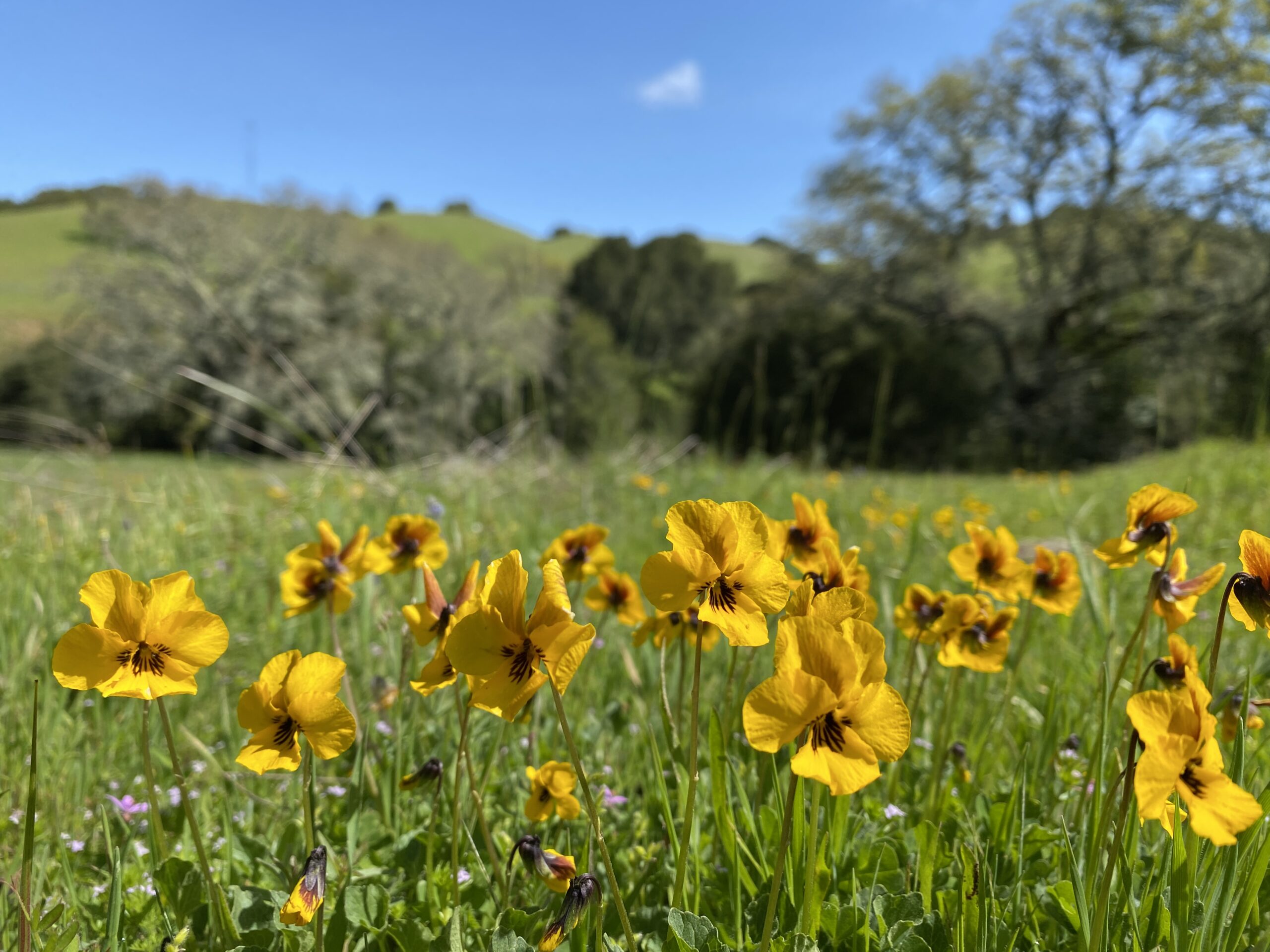


Grasslands in the region and throughout the state are dominated by non-native plant species, but they support diverse ecosystems. Approximately 90% of species listed in the inventory of rare and endangered species in California occur within grasslands. Additionally, grasslands support birds, pollinators, and other wildlife that are dependent upon grasslands’ low vegetative height and open structure, as well as the seed, pollen, and forage they provide.
What metrics determine the health of this indicator?
Metric 1
Membership of selected grassland types within a classification system.
Unknown
Unknown
Low Metric 1
Membership of selected grassland types within a classification system.
Geographic Area
Condition Thresholds
Good
All grasslands selected for monitoring continue to meet established native plant membership rules in five or more years over a 10-year monitoring period.
Caution
Any of the grasslands selected for monitoring only meet established native plant membership rules in two to four years over a 10-year period.
Significant Concern
Any of the grasslands selected for monitoring do not meet established native plant membership rules in one or fewer years monitored over a 10-year period.
Metric Current Health Findings
Current Condition
Unknown. Sentinel sites have not been selected or monitored.
Current Trend
Unknown. Trends may be assessed once multiple years of data have been taken.
Current Confidence
Although individual agency and research-based plant community monitoring data is available in portions of the area of focus, a representative and shared baseline plant community dataset is not available and so the confidence is low.
Rationale - Why It's Important
Resilient grasslands include the presence of native grass and/or forb species (Craine et al. 2013, Hoover et al. 2014). Historic grassland plant communities supported a higher diversity and cover of native plant species than are currently observed (Cunningham 2010). Carbon sequestration rates are greater in native perennial grass stands (Koteen et al. 2011).
Goal
Maintain or improve native species cover and/or richness in selected grassland classes for each of the landscape units, as per membership rules in a classification system (e.g., Manual of California Vegetation).
Baseline Description
Native grass and forb species cover and/or richness may be monitored when more fine-scale grassland mapping and classification is available in the area of focus. Once grasslands have been mapped according to a classification system, such as the Manual of California Vegetation (MCV), Network partners may select a subset of grassland classes that warrant long-term monitoring.
Metric 2
Total acreage of grasslands within grassland landscape units.
Unknown
Unknown
Low Metric 2
Total acreage of grasslands within grassland landscape units.
Geographic Area
Condition Thresholds
Good
Current total acreage of existing grasslands is maintained within 1%, or increase spatial extent within a given landscape unit.
Caution
Decrease in total acreage of existing grasslands by 1-3% within a given landscape unit.
Significant Concern
Decrease in total acreage of existing grasslands by more than 3% within a given landscape unit.
Metric Current Health Findings
Current Condition
Unknown. Only a small portion of the three landscape units had reliable historical grassland extent data. Condition may be determined if this historical dataset is expanded and/or future mapping efforts are compared to current condition as a baseline.
Current Trend
Unknown. Additional historical data is needed to establish a trend for all landscape units. Conversely, the current baseline may be used for future comparisons.
Current Confidence
Available time series data that cover the entire area of focus are temporally limited and inaccurate at a meaningful scale. Available datasets have known errors, including inconsistent or unknown original mapping techniques (Kelly et al. 2005), inaccurate polygon delineation (ibid), limited ground truthing (Tukman Geospatial 2023, CLN 2011, Stanford et al. 2011, Kelly et al. 2005), and variable definitions of key grassland types (Kelly et al. 2005, Tukman Geospatial 2023, CLN 2011, Stanford et al. 2011, ECCCHC 2014).
Rationale - Why It's Important
Maintenance of existing grassland acreage is important for supporting grassland-dependent wildlife and plant species, as well as viable livestock operations that may be used as a management tool. Maintenance of existing grassland acreage indicates that the area of focus continues to provide grassland-associated ecosystem services.
Goal
Maintain or increase current spatial extent of total grassland acreage.
Baseline Description
The five partner agencies manage over 107,000 acres of grasslands in the area of focus. The grassland acres were calculated by using a combined dataset based primarily on the draft lifeform map provided by Tukman Geospatial (2023) for Alameda and Contra Costa Counties and other existing vegetation data sources for San Joaquin and Santa Clara Counties. Ongoing efforts to classify and map vegetation across Alameda and Contra Costa Counties will provide a more accurate set of acreages. Existing historical vegetation data from approximately 1850 (Stanford et al. 2011) covers a portion of the Mount Diablo Range landscape unit. However, this dataset is not complete for the entire area of focus. Furthermore, 1850 may or may not be an appropriate baseline as it acts a snapshot of vegetation management practices at a given time. If the historical dataset is expanded, it may be considered for use as a baseline, considering its limitations.
Metric 3
Average patch sizes greater than 25 acres within grassland landscape units.
 Caution
Unknown
Low
Caution
Unknown
Low Metric 3
Average patch sizes greater than 25 acres within grassland landscape units.
Geographic Area


Condition Thresholds
Good
Average grassland patch size is at least 25 acres within each landscape unit.
Caution
Average patch size is between 15 to 25 acres within each landscape unit.
Significant Concern
Average patch size is less than 15 acres within each landscape unit.
Metric Current Health Findings
Current Condition
Current condition is Good based on the average of conditions below:
- Mt. Diablo Range, Mt. Hamilton: Good.
- East Bay Hills: Significant Concern.
The overall condition is Good because the average patch size across all landscape units is 30 acres, which is above the 25-acre threshold. However, condition varies by landscape unit: only Mount Diablo Range and Mount Hamilton Range had average patches greater than 25 acres while East Bay Hills had an average patch size less than 15 acres.
Current Trend
Unknown. Additional historical data is needed to establish a trend. Conversely, the current baseline may be used for future comparisons.
Current Confidence
Confidence is Low. The most accurate mapping of historical and modern vegetation is limited to portions of the Mount Diablo Range landscape unit. Only relatively coarse modern (Tukman Geospatial 2023, EHA 2023, and CLN 2011) and historical (Kelly et al. 2005) vegetation classification and mapping data was available for the entire area of focus. An improved classification and mapping effort of the entire area of focus would vastly improve estimations of baseline, threshold, and trends in grassland patches within all landscape units.
Rationale - Why It's Important
Larger grassland patches with greater inter-patch connectivity and higher intra-patch habitat heterogeneity are more likely to support viable populations and greater diversities of grassland-associated pollinators, native plant species, and sensitive wildlife species. The patch size thresholds of this worksheet are based on regional to global studies. Studies focusing on grass-specific ecosystems were selected over wildlife-related patch sizes because wildlife metrics are discussed in other chapters. Future iterations of this metric may incorporate wildlife-related patch size into the thresholds.
Large patches inherently have more habitat diversity and can accommodate larger and more genetically diverse populations of critical species. Larger patch sizes also reduce negative edge effects (e.g., invasion and predation) for sensitive species. Patch connectivity improves potential gene flow of grassland plant species, which is dependent on dispersal and exchange of pollen and seeds within and between populations. Greater genetic diversity within and gene flow between populations improves the potential for species to adapt to changing conditions.
Multiple studies identified a distinct benefit conferred to pertinent ecosystem services at 20 to 30 acres. Twenty-five acres was selected in order to identify an appropriate threshold that would indicate grassland health. Although 25 acres was selected as the minimum recommended patch size, many studies also stated that larger in general is better. However, since there were no additional thresholds above the 20-to-30-acre range, it was not appropriate to assign a second larger tier for assessment at this time.
Goal
Maintain or increase average grassland patch size within each landscape unit to be over 25 acres.
Baseline Description
The existing vegetation data provided by CLN (2011) may serve as an interim baseline until more accurate mapping is completed. The historical vegetation map (Standford et al. 2011) is not currently used as a baseline but may be considered if the map extent expands.
About this Indicator
Grasslands are the most widespread vegetation type in the area of focus. They are among California’s most altered ecosystems, with non-native plants making up more than 90% of the cover in most grassland areas (Mooney and Zavaleta 2016). Even in their current altered state, grasslands are extremely important for wildlife and support a high diversity of native plant species. Resilient grasslands provide habitat for native species, supply quality forage to livestock, support water recharge, protect landscapes from erosion, and participate in the nitrogen and carbon cycles.
Why is This Resource Included?
Grasslands provide critical ecosystem services in the area of focus, including attenuation of storm water with relatively slow infiltration rates, and improvement of water quality through filtering of pathogens, nutrients, and sediments (Mooney and Zavaleta 2016). They also provide a relatively high rate of carbon storage per unit area based on plant community composition, clay content, litter cover, and potentially management (Silver et al. 2010, Booker et al. 2013, Conant et al. 2001). Grasslands are more likely to remain carbon sinks than forested lands (Dass et al. 2018). Within grasslands, native perennial grasslands sequester greater levels of carbon over annual grasslands, and both types of grasslands sequester greater levels of carbon than developed croplands (Koteen et al. 2011, Conant et al. 2001). Grasslands also support a wide diversity of pollinators (Colteaux et al. 2013).
Desired Condition and Trend
Resilient grasslands are better able to persist in more extreme environmental conditions, such as prolonged drought and increased temperature ranges (Hoover et al. 2014, Voltaire et al. 2014). Diversity of plant species within a community, genetic variation within taxa, and plasticity of physiological traits of constituent plants contribute to a resilient grassland (Harrison et al. 2015, Vicente-Serrano et al. 2013, and Craine et al. 2013). Resilient grasslands provide habitat for native species, supply quality forage to livestock, support water recharge, protect landscapes from erosion, and participate in the nitrogen and carbon cycles. The desired condition is to maintain, support, or create resilient grasslands within a broader ecosystem in the face of climate change and anthropogenic impacts. The resilience of the grasslands in the area of focus may be assessed by native grass and forb species cover and/or richness, current spatial extent (acreage) of grasslands, and patch size.
Current Condition and Trend
Inadequate data exist to assess the overall condition and trend of grasslands in the area of focus according to the selected metrics. Some initial assessments have been made for portions of the area of focus where adequate data is available, as described for each metric. A comprehensive mapping and classification of historical and current vegetation types throughout the area of focus will dramatically improve the accuracy of the condition assessment by creating spatially-explicit grassland areas to assess and monitor for native species diversity and abundance, total acreage, and patch size.
Stressors
Climate Change
Environmental changes brought by climate change may include increased CO2 levels, increased nitrogen deposition, increased temperature, and changes in timing and distribution of precipitation. These changes in isolation or combination may alter grassland species composition and productivity, generally facilitating increased dominance of non-native annual grass species. Grassland community changes were found to be dependent on the type of environmental changes, but a general decrease in forb diversity was apparent for most scenarios (Zavaleta et al. 2003). Elevated CO2 may reduce plant productivity, increase lignin in grasses, and increase forb biomass (Henry et al. 2005, Henry et al. 2006). Increases in available nitrogen, largely from regional anthropogenic sources, may increase the competitive edge of non-native annual grass species within previously edaphically-limiting grasslands, such as those on serpentine soils (Weiss 2001, Vallano et al. 2012). In an annual grassland community, litter decomposition increased (Henry et al. 2006), and overall diversity, especially of forbs, decreased with increased nitrogen (Zavaleta et al. 2003, Harpole et al. 2007).
Direct Human Impacts
Facility management, maintenance, and development: The lands within the area of focus are managed for a diverse set of goals and land uses, primarily recreation and water storage and conveyance, that may reduce grassland health or extent. Recreational and water systems facility management, maintenance, and development directly impact area of focus grasslands. Facilities associated with these primary land uses generally require construction, expansion, and/or ongoing maintenance. On managed watershed lands, initial grassland acreage was lost to reservoir and water conveyance infrastructure construction, and may continue with expansion. Area of focus lands that are managed for recreation have reduced grassland extent in discrete areas for facility development (e.g., parking lots, visitor centers). Ongoing facility management may include use of pesticides, mowing, and ground clearing, which may impact adjacent grasslands. Utilities, such as gas or power lines, with easements on area of focus lands also require maintenance and replacement, causing ground disturbance and altering plant communities.
Recreation: Many of the area of focus grasslands support passive recreational use, including hiking, birdwatching, mountain biking, and horseback riding. Potential impacts from passive recreational use include increased erosion and associated sedimentation along roads and trails, as well as increased introduction of non-native invasive plant and pathogen species. Although designated trails may be maintained regularly to reduce erosion and off-trail sedimentation, unofficial social trails may not be designed properly or maintained to convey water, leading to erosion, gullying, and off-trail sediment deposition (Marion and Olive 2006). Trail and road networks within grasslands serve as vectors for potentially harmful plant and pathogen taxa that may become established if not identified and targeted soon after establishment (Potito and Beatty 2005, Ballantyne and Pickering 2015).
Fire Regime Change
The existence and distribution of area of focus grasslands are associated with ongoing and historic disturbance regimes, including fire. The fire regime includes location of burns, fuel types and levels, fire frequency, seasonality, and intensity (Keeley et al. 2011).
Current fire suppression and exclusion practices in the region and state differ from the more frequent historic anthropogenic burns utilized by Native Americans and Euro-American livestock operators to maintain and expand grasslands (Rutherford et al. 2020, Stephens et al. 2007), but may be more consistent with pre-human contact burn levels (Keeley 2002). Recent large-scale and high intensity burns in the Bay Area, including parts of the area of focus, may indicate yet another shift in fire regimes to come (Westerling and Bryant 2008). These fire regimes impact the distribution of plant communities, as discussed with scrub encroachment, as well as grassland plant community composition, particularly related to disturbance-dependent native and invasive species (Keeley 2001).
Other Stressors
Grazing Management: All of the grasslands in the area of focus are assumed to have historical livestock grazing; most support ongoing seasonal or year-round domestic livestock grazing; and all continue to receive some level of herbivory from native wildlife, including ungulates, small mammals, and invertebrates. Livestock use has been noted as a potential threat to various sensitive plant and wildlife species over time (CNDDB 2020). Concerns include direct loss of individuals from trampling or incidental consumption, as well as indirect effects from alteration of plant communities and ecosystem function (Painter 1995). Livestock grazing management is complex and requires balancing often oppositional goals. For example, livestock grazing has been shown to improve grassland habitat for wildlife species and also increase native forb richness and native grass cover while increasing invasive forb cover (Stahlheber and D’Antonio 2013).
Habitat Disturbance/Conversion/Loss
Shrub encroachment: The western extent of the area of focus features a dynamic mosaic of grassland and northern coastal scrub, consisting primarily of coyote brush (Baccharis pilularis ssp. consanguinea) scrub (Keeley 2005). Since the grasslands closer to the coast have higher moisture from fog and precipitation, shrub encroachment is more prevalent there. Coyote brush scrub has the potential to dominate in coastally influenced grasslands in the absence of disturbance (Hobbs and Mooney 1986). Studies of historical vegetation change in the East Bay Hills has shown a dramatic shift from grassland to coyote brush due to lack of fire and grazing (McBride and Heady 1968, McBride 1974, Keeley 2005).
Habitat fragmentation and edge effects: Smaller, more irregularly shaped habitat patches have an increased perimeter to area (P/A) ratio than larger, more circular habitat patches. The increased P/A ratio causes the interior portions of the patch to be relatively closer to the edges. The proximity to habitat edges causes an increase in often negative impacts, termed edge effects (Jørgensen and Fath 2008). Habitat fragmentation may reduce the success of grassland-dependent plant and wildlife species and populations by increasing predation and invasion, and reducing dispersal and gene flow. Specific effects from habitat fragmentation and increased P/A ratio vary by existing species composition, adjacent habitat types, and characteristics of the impacted species (Robinson et al. 1995, Quinn and Robinson 1987, Collinge and Palmer 2002). While the area of focus is limited to protected lands, grasslands throughout the region and state have historically and continue to become reduced in overall acreage and patch size, increasing edge effects.
Invasive Species Impacts
Non-native plant species have dramatically altered grasslands in the area of focus and throughout the state, causing a complete shift in species composition and associated ecosystem processes. Two major suites of non-native grassland species have invaded the grasslands within the area of focus: 1) an initial invasion of now naturalized species (e.g., oats and bromes) that occurred during early Euro-American livestock grazing, and 2) a novel set of invasive species that are increasing in extent (e.g., medusa head [Elymus caput-medusae] and false brome [Brachypodium distachyon]; Bartolome et al. 2007). Invasive species outcompete native species for resources and reduce native plant persistence and cover. Invasive species may alter ecosystem processes (e.g., fire frequency, carbon storage), and may create conditions that favor their own reproduction and dominance (e.g., thatch persistence, allelopathic chemicals; Koteen et al. 2011). These species also have the potential to negatively impact native pollinators and other associated wildlife species (Bossard and Randall 2007). Wild pigs are the primary non-native wildlife species of concern for area of focus grasslands as they consume native geophytes and increase ground disturbance from rooting, which further alters the plant community and facilitates exotic plant species (Cushman et al. 2004).
Additional Resources
Other Metrics Considered but Not Included
- General note: Future worksheet versions may assess different metrics for each of the landscape units. These metrics may be tailored to address and monitor specific concerns facing individual landscape units. This approach would ensure that each metric is most applicable, best studied, or otherwise most appropriate for each landscape unit. Results from the ongoing fine-scale grassland mapping effort may justify separating out metrics of interest.
- Structural diversity in grasslands – This was removed since it was primarily a metric for wildlife use. Structural diversity was removed from the grassland metrics because there are other indicators evaluating stressors to wildlife that use grasslands.
- Interior grassland subtypes: native cover and richness – This metric was combined with the current Metric 1 that assesses native grass and forb species richness and/or cover in order to encapsulate a greater potential range of monitored grasslands types. The monitored grassland types have yet to be selected for each landscape unit and may include serpentine and alkali grassland types in the units where they occur. Vernal pools and alkali wetlands are both uniquely characterized by the presence of native and endemic plant species (as well as their unique hydrology and soil types), but are distinctly wetlands although within a larger grassland matrix.
- Patch distribution – Research on grassland patch distribution in the state and globally indicated that immediate patch connectivity was important for maintaining grassland-associated species and populations. Little pertinent literature was found that recommended specific distances between grassland patches beyond identifying that connected, more frequent, and adjacent habitat patches improved success of grassland-associated species (Ehrlich and Murphy 1987, Soons et al. 2005, Jacquemyn et al. 2010). Connected or adjacent grassland patches are considered one unit or patch in this worksheet. Within-patch diversity, addressed below, describes a potential metric examining the importance of adjacent diverse patches.
- Within-patch diversity – A future iteration of this worksheet may incorporate a metric similar to the following: “Maintain or increase diversity of adjacent/connected grassland patch types.” Multiple studies of grassland pollinators and seed dispersal mechanisms indicate that fine-scale heterogeneity within larger grasslands improves local population outcomes (Ehrlich and Murphy 1987, Soons et al. 2005, Steffan-Dewenter and Tscharntke 2002). This type of metric would only be possible after a relatively fine-scale classification and mapping effort is completed for the area of focus where adjacent grassland types may be considered as a heterogenous unit.
- Thatch and bare ground – Some sensitive plant communities, such as vernal pools and serpentine grasslands, have been shown to respond positively to lower thatch and higher bare ground levels, often maintained through grazing management (Marty 2005, Weiss 2001). However, there is a lack of studies quantifying recommended thatch, biomass, and bare ground levels in relation to diversity and abundance of most native plant species that are generally found intermixed within the dominant grassland type. While a specific metric for thatch and bare ground was not selected for this iteration of the indicator worksheet, inclusion of biomass and bare ground monitoring as part of monitoring grassland diversity should improve the understanding of potential bare ground and thatch impacts on grassland communities of interest.
- Invasive Species – Although new problematic invasive grass species (e.g., false brome, medusa head) are a serious threat to regional grassland plant communities, dominant and subtype grassland community health is adequately addressed by Metric 1, which directly measures native plant diversity and abundance. Measurement of invasive species cover, individually or as a guild, as part of monitoring would help inform individual or regional management decisions.
Data Gaps and Data Collection/Management Needs
- Metric 1: Native grass and forb species cover and/or richness
- Grasslands in the Bay Area have several datasets that are relatively consistent in how species composition is measured, but the locations of the monitoring plots are not representative of all grassland plant community types and are not well distributed throughout the area of focus. There are some site-specific species composition monitoring data (EBRPD, SFPUC, State Parks), but the distribution of monitored plots reflects other research or management goals and does not accurately represent the variety of grassland classes of interest for this metric.
- A thorough classification and mapping effort of target current and historical vegetation types throughout the area of focus would inform more methodical monitoring of all metrics in this worksheet. If the mapping effort is based on the MCV or another suitable classification system, a representative subset of the mapped grassland areas could then be monitored to assess baseline and change in native grass and forb species richness in relation to explicit membership rules in the classification system. In the case that a comprehensive classification and mapping effort throughout all vegetation types of the area of focus is not feasible, the following alternatives may be more attainable in the near term: 1) map current (and historic, if possible) vegetation within a representative subset of partner lands within each landscape unit; 2) focus on mapping and classifying existing grasslands rather than all vegetation types; 3) map and classify selected properties in the area of focus that anecdotally harbor the greatest diversity of potential grassland classes; and/or 4) map broad historical vegetation classes in representative area of focus properties in Contra Costa County, where historical photography is readily available.
- Once a full-scale or modified mapping and classification effort has been implemented in the area of focus, a set of grassland classes should be selected for long-term plant community monitoring to better inform Metric 1. The grassland classes selected for ongoing monitoring should include dominant, unique, and/or sensitive grassland plant communities that are characteristic of each landscape unit. Long-term plot-based plant community monitoring could then occur at multiple locations per selected class, ideally representing a range of geographic, edaphic, and land use histories, where available. The number of classes and replicates within each class selected for regular monitoring may vary by agency availability and funding.
- Alkali grasslands and sinks were not included in this assessment. Upland alkali grasslands are often transitional areas between alkali wetlands and dominant interior grasslands, featuring more common native grassland species (e.g., salt grass) but generally lacking the more unique suite of sensitive native plant species found in the wetter areas. Analysis of California Natural Diversity Data Base (CNDDB) data in the region confirmed that sensitive plant species, such as various listed Atriplex species, were almost exclusively associated with wet alkali features rather than the upland alkali grasslands (CNDDB 2020). Also, it is anticipated that a relatively robust vegetation mapping effort throughout the area of focus would likely capture notable alkali grassland stands.
- Unique plant communities associated with clay barrens, which are generally found on Altamont-Fontana and Altamont clay soil types, have not been well studied. While anecdotal evidence and white literature have indicated associations with a few listed plant species such as shining navarretia (Navarretia nigelliformis ssp. radians), clay barrens may also support unique assemblages of more common native plant species (Nomad 2015). Future iterations of this worksheet may incorporate clay barrens as a monitored subtype when more widely available data to support its inclusion are available.
- Metric 2: Spatial extent of grasslands
- The region-wide modern vegetation mapping effort undertaken by CLN lacks significant ground-truthing and is largely based on coarse state-level landscape classification work (CLN 2011). The East Contra Costa County Habitat Conservation Plan (ECCCHCP) process included improved mapping of recent vegetation types within a portion of the Mount Diablo Range landscape unit (ECCCHC 2014). Tukman Geospatial (2023) also improved the accuracy of the remotely sensed vegetation type data with more recent imagery. All acreage calculations and analyses carry the inaccuracies of the source datasets.
- Existing historical vegetation mapping datasets are problematic for use in trend analysis and establishment of meaningful thresholds for this worksheet. Region-wide historical vegetation mapping (Kelly et al. 2005) was assessed for relative accuracy in comparison to Contra Costa 1939 aerial photography (Google Earth 1939). Many errors in the historic vegetation map were detected that would influence acreage calculations of vegetation types and subsequent analyses of changes between historical and modern plant communities. However, a more careful and fine-scaled mapping effort was undertaken for the ECCCHCP to estimate plant community extents in 1850 (Stanford et al. 2011).
- Historical vegetation type mapping that characterizes basic vegetation classes (e.g., grassland, oak woodland, chaparral) would provide context for grassland acreage and patch gains and losses. Mapping current and historic non-grassland vegetation types would improve understanding of how area of focus grasslands have changed over time and the relationships between other land cover types of interest. For example, mapping all vegetation types would allow ecologists to estimate the number of grassland acres transitioning between coyote brush scrub, oak woodland, and wetlands.
- Metric 3: Patch size
- Few studies regarding key grassland patch size and distribution exist within the area of focus. Various studies from outside the region or state reflect potential patch-related recommendations to support general grassland-associated ecological services.
- Grassland-associated wildlife patch sizes were not included in this version of the assessment. Future iterations may incorporate findings from studies relating to preferred or necessary grassland patch sizes for key wildlife taxa or guilds, such as grassland birds, granivores, California tiger salamander (Ambystoma californiense), California red-legged frog (Rana draytonii), San Joaquin kit fox (Vulpes macrotis) and/or California ground squirrels (Otospermophilus beecheyi).
Past and Current Management
Grassland management in the area of focus is largely informed by general plans, long-term management plans, or individual grazing unit management plans prepared by Network partners or others to address site-specific concerns. Many of the Network partners employ monitoring-based adaptive management approaches that allow for up-to-date research and monitoring results to inform management decisions based on specific goals and objectives. The type, frequency, and extent of grassland monitoring varies between Network partners based on funding, availability, and resources targeted for monitoring. Many monitoring efforts are project-based and are tailored to examine specific metrics of concern (e.g., bare ground, guild cover). These small-scale monitoring efforts are important for site-specific management but may not account for region-wide issues of concern.
The ten-year grassland plant and bird community monitoring conducted by the UC Berkeley Range Lab (Bartolome et al. 2011) was one of the most comprehensive studies of grassland communities in the area of focus. The project produced summaries of community change over time and provided range management recommendations for enhancing native plant and grassland bird abundance, managing invasive plant species, and monitoring grazing effects on plant and bird communities.
EBRPD is currently leading a classification and mapping effort covering Alameda and Contra Costa Counties according to the most up-to-date CNPS and CDFW vegetation classification and mapping protocols. The effort is underway and anticipated to conclude in 2024. Associated with this effort, EBRPD is leading a fine-scale grassland mapping effort slated to map approximately 10,000 grassland acres at the lowest feasible classification level (e.g., alliance or association) to complement an existing 2,000 acres of fine-scale mapping recently completed. The classification will be supported by conducting over 200 relevé plots. This effort will directly inform future iterations of this worksheet, as well as management decisions and Network planning.
Potential Future Actions
- Utilize anticipated fine-scale grassland map to examine plant community patches in terms of relative sizes, as well as inter- and intra-patch dynamics over time and in relation to key wildlife taxa.
- Assess the interaction of grazing levels, thatch, and bare ground on plant communities of concern replicated across subregions.
- Improve understanding and mapping of clay barrens and old growth grasslands within the area of focus.
- Develop a consistent set of monitoring methods across Network partners.
Key Literature and Data Sources
For additional information about this indicator including key literature and data sources see Grasslands Indicator NatureCheck Report